In your area
As we have developed our proposals, we have listened to communities to make sure that we leave a positive legacy for local people long after construction is complete. The Ward impact summaries explain how we have assessed and developed proposals to mitigate impacts of the project on local communities.
Pick your area on the map or scroll down for an outline of the main impacts in each ward, during and after construction, and what we plan to do to mitigate them.
The Ward impact summaries explain how we have assessed and developed plans to mitigate any impacts of the project.
Topics covered in each summary are:
- Traffic
- Public transport
- Footways, bridleways and cycle paths
- Visual
- Noise and vibration
- Air quality
- Health
- Biodiversity
- Built heritage
- Contamination management
You’ll find links to the full Ward impact documents and their ward-specific maps. For information on an even larger scale you can also see:
Summary of impacts by ward
Overview of Higham ward
- Located: south of the River Thames in the borough of Gravesham and to the east of Shorne, Cobham and Luddesdown ward
- Area: around 13km sq
- Estimated population: 3,868 (Source: ONS)
Higham ward includes Higham and Lower Higham villages to the north-west of the A226 Gravesend Road, along with areas of farmland and open space to the east and north, which include footpaths and bridleways. Higham station is located within the ward in Lower Higham, served by Southeastern and Thameslink services.
The M2, including junction 1, runs along the southern boundary of the ward.
Traffic
During construction
Impacts: Construction traffic accessing the compounds would use the A226, leading to some delays at the junction of the A226 with the A289, and slower journey times along the A226. Traffic management measures on the A2 may result in additional local traffic using the A226.
Mitigation: Several mitigation measures have been adopted to reduce the impacts during the construction period, such as only using one construction route for HGV traffic – the A226 Gravesend Road and the A289.
When the road is open to traffic
Impacts: An increase in traffic flows is expected on the A226 Gravesend Road, the A289 and the A2 once the project is operational. Only small changes in flows are predicted on other minor roads within the ward.
Analysis on the traffic flow increases and impacts can be found in the full Higham Ward impact summary document.
Mitigation: A2/M2 widening works would be done during the construction of the project to ensure the A2/M2 can accommodate the increased traffic flows, reducing the impact of the project on the local road network.
Public transport
During construction
Buses: Bus services along the A226 Higham Road may experience delays because of the impacts on journey times along the A226 and at the junction with the A289.
Rail: There would be no impact on train services in Higham ward and access to Higham station would not be affected during construction.
When the road is open to traffic
Buses: There would be no discernible impact on bus services once the project is operational.
Rail: There would be no discernible impact on rail services once the project is operational, nor on journey times the Higham station.
Footpaths, bridleways and cycle routes
During construction
Impacts: The cycle route along the A226 Gravesend Road would be affected by lane closures and traffic signals put in place while accesses to construction compounds are built.
Mitigation: This cycle route would remain open, with impacts only during the first year of construction while works on the A226 take place.
When the road is open to traffic
None of the footpaths, bridleways or cycle routes in Higham ward would change once the project is operational.
Visual
During construction
Impacts: Views of the construction of the project would be limited, but there would be some from residential areas including the western end of Old Watling Street, Strood and along the A226 Gravesend Road.
New landscaping as well as the Northern Tunnel Entrance Compound would be visible in the distance from Saxon Shore Way long-distance footpath.
Mitigation: No specific measures to reduce visual impacts are required given the distance and limited views of construction activities.
Operations
Impacts: There would be minimal views of the project once the new road is open to traffic. There may be greater visibility of the M2 corridor from Higham until new planting establishes.
Mitigation: Planting removed during construction of the project would be reinstated along the M2 corridor.
Noise and vibration
During construction
Impacts: Construction activities associated with the widening of the M2 are expected to create noise. There would also be 24-hour, 7-day construction working in particular locations.
There would be negligible changes in noise from road traffic for most roads within this ward during the construction period, except along Peartree Lane, Lower Road, Lower Rochester Road and slip roads onto Hasted Road off Gravesend Road where minor increases in noise levels have been predicted.
Mitigation: Construction noise levels would be controlled through mitigation measures presented in the Register of Environmental Actions and Commitments (REAC) included in the Code of Construction Practice (CoCP) (PDF 1.3MB).
When the road is open to traffic
Impacts: Changes in noise may result from changes in traffic flow, traffic speed and the proportion of HGVs on existing roads, as well as from physical changes to the A2/M2 in the south of the ward. This is predicted to range from a negligible reduction to a minor increase in noise.
Mitigation: Low-noise road surfaces would be installed on all new and affected roads including the A2/M2 as part of the upgrade works.
Air quality
During construction
Impacts: Residents within 200m of the project (east of the A2/M2 junction and west of the A226/A289 junction off Gravesend Road) may experience dust and emissions from construction equipment and traffic during the construction phase.
Our analysis of construction traffic predicts that the impact on most roads in this ward would be negligible, although there would be a temporary minor worsening in air quality in the area around Chalk Road and A226 Gravesend Road because of traffic resulting from our traffic management and construction vehicles from 2026 to 2027.
Mitigation: The contractor would follow good practice construction measures which are presented in the CoCP and REAC to minimise the dust. Construction vehicles would need to comply with emission standards.
An Air Quality Management Plan would be designed in consultation with the relevant local authorities. The plan would include details of monitoring which would ensure measures are effectively controlling dust and exhaust emissions.
When the road is open to traffic
Impacts: There are no predicted exceedances of NO2 or PM10.
Mitigation: As there are no predicted exceedances, no mitigation has been proposed.
Health
During construction
Impacts: The construction phase of the project would present opportunities to access work and training.
Changes in the area may result in negative impacts on health, including mental health and wellbeing. These include changes in accessibility of local resources and amenity as a result of construction traffic using the A226, as well as mental health and wellbeing impacts associated with stress and anxiety relating to the construction of the project.
Mitigation: The negative impacts would be mitigated through the good practice construction measures presented in the CoCP and REAC relating to dust emissions, working hours and visual screening, traffic management measures and community engagement. This includes the establishment of Community Liaison Groups.
When the road is open to traffic
Impacts: There would be improvements in the accessibility of local facilities and amenities, better access to jobs and training, and to open spaces including new recreational areas outside Higham, such as Chalk Park, near Gravesend.
The operation of the project may give rise to some stress-related impacts.
Mitigation: No mitigation measures for health have been included.
Biodiversity
During construction
Impacts: A small area of landscape planting would be removed around junction 1 of the A2/M2 as part of construction.
Mitigation: Landscape planting would be cleared in winter, where possible, to avoid impacts on breeding birds. It would be reinstated once construction is complete in this area.
New woodland planting is also proposed north of Park Pale bridge. Although this is outside of Higham ward, it would provide strong connections between existing woodland in the ward.
When the road is open to traffic
Impacts: The operation of the new road could cause mortality of species by encountering road traffic, as well as habitat fragmentation and disturbance from traffic. This risk is not expected to exceed the current level of risk at the A2/M2.
Mitigation: Appropriate fencing would keep some animals away from the new road. Newly created habitat would be designed to reduce fragmentation. Good practice measures, as set out in the CoCP and REAC, would be implemented.
Built heritage
During construction
Impacts: Construction activity would have minimal impact on built heritage but may cause minor changes to the settings of some built heritage by introducing additional noise and lighting.
Mitigation: Mitigation measures have been included in the REAC relating to air quality, noise and vibration.
When the road is open to traffic
Impacts: No impacts have been identified.
Mitigation: Although no impacts have been identified, note that road lighting would be minimised where it is safe and practicable to do so. See LST.02 and LST.03 in our Design Principles (PDF 8.1MB).
Contamination
There are no known sources of contamination that could be at risk of being disturbed during construction or operation of the project within the Higham ward.
Overview
- Located: south of the River Thames in the borough of Gravesham
- Area: around 34km sq
- Estimated population: 4,272 (Source: ONS)
Shorne, Cobham and Luddesdown ward includes a substantial portion of the Order Limits (the area of land required to construct and operate the project, also known as the development boundary) south of the river. Higham ward is to the east, with Chalk, Westcourt, Riverview, Singlewell, Woodlands and Istead Rise wards to the west. The main population centres in the vicinity of the project are the eastern edge of Gravesend, along with the villages of Thong, Shorne, Shorne Ridgeway and Cobham.
The North Kent railway line runs east-west following part of the alignment of the Thames and Medway Canal. The High Speed 1 (HS1) railway line runs east-west through the ward immediately south of the A2/M2, with the Chatham main railway line south of Cobham.
The land between the villages of Thong and Shorne, and to the south of the A2 including Cobham and Luddesdown, forms part of the Kent Downs Area of Outstanding Natural Beauty (AONB).
Within the ward, located around Thong and the A2/M2 are multiple utility networks impacted by the project. These include local distribution networks and nationally important transmission networks such as electricity overhead lines and gas pipelines.
Traffic
During construction
Impacts: Traffic management works would result in increased journey times on a number of routes, and some temporary closures would require longer journeys for extended periods. Increased traffic along the A226 associated with construction would also increase journey times along this road.
Mitigation: There are several ways – including minimising the use of local roads for construction purposes – that we would reduce the impact of the construction process on Shorne, Cobham and Luddesdown ward.
When the road is open to traffic
Impacts: In the north of the ward, a small increase in traffic flows is predicted along Brewers Road, Pear Tree Lane and the A226.
In the south of the ward, traffic is predicted to decrease on Halfpence Lane, The Street and Sole Street. An increase is predicted on Jeskyns Road and Henhurst Road. In addition, increases are predicted along the A2 where the project lies within the ward.
Mitigation: To mitigate the impacts of the project on Shorne, Cobham and Luddesdown during the operational phase, mitigation such as additional connector roads to the project have been included.
More details about the changes to traffic and the predicted impacts can be found in the full Ward impact summary document.
Public transport
During construction
Buses: Local bus services using the A226 and regional coach services using the A2 would have increased journey times during construction.
Rail: There would be no impacts on rail services during construction, nor on access time to Higham station.
When the road is open to traffic
Buses: There would be no changes to bus routes through the ward required once the new road opens and no discernible change to most bus journey times. One bus route, the 695, would experience a two-minute increase in journey time.
Rail: There would be no discernible change in access times to Higham station or changes to rail services from that station once the project is open.
Footpaths, bridleways and cycle routes
During construction
Impacts: Due to the extensive construction works in this ward, there would be impacts on numerous footpaths, bridleways and cycle routes.
Mitigation: Temporary and permanent diversions would be provided for some routes to maintain connectivity during construction, while those that are unable to be diverted would be closed for as short a time as possible to reduce the impact on the local public right of way network.
When the road is open to traffic
Impacts: Some footpaths, bridleways and cycle routes would be permanently rerouted. Walking, cycling and horseriding facilities would be included as part of the new green bridges at Thong Lane over the project and Brewers Road.
Mitigation: We are proposing to upgrade several footpaths to make them suitable for walking, cycling and horseriding, while also providing additional links to connect existing routes.
Visual
During construction
Impacts: Construction activities would be visible from residential properties, community amenities and footpaths, including utility diversions and compounds.
Mitigation: Views of earthwork stockpiles would be softened by using grass-seeded slopes. Fencing would be installed around compounds.
When the road is open to traffic
Impacts: Once the new road is open, the main changes in views from residential properties, community amenities and footpaths would be of the proposed A2/M2 junction (landscaping and false cutting) and the new Chalk Park.
Mitigation: New planting would soften the views from residential properties, community amenities and footpaths as it becomes established.
Noise and vibration
During construction
Impacts: Construction of the widening of the A2/M2, the new A2/M2 junction, the southern tunnel entrance and the new road is expected to create noise. There would also be 24-hour, seven-day construction working in some locations.
There would be negligible changes in noise from road traffic for most roads within this ward during the construction period, except along roads where increases in noise levels have been predicted.
Mitigation: Construction noise levels would be controlled through mitigation measures presented in the Register of Environmental Actions and Commitments (REAC) included in the Code of Construction Practice (CoCP) (PDF 1.3MB).
When the road is open to traffic
Impacts: There would be increased levels of noise on the south-western side of the ward, coming from the new road including the proposed A2/M2 junction and upgrades to the existing A2/M2 carriageway. Noise levels would also increase from existing roads due to the changes in traffic flow, speed and vehicle type.
Mitigation: Low-noise road surfaces would be installed on all new and affected roads. Acoustic screening (noise barriers) has been incorporated into the design where necessary. The design of the new road and tunnel entrance/exit has been kept low in the environment (this controls the noise).
Air quality
During construction
Impacts: Analysis of traffic data along the A2 corridor shows that likely decreases in traffic between 2026-2028 would lead to a small temporary improvement in air quality. The A226 Gravesend Road is expected to experience an increase in traffic flows from 2026-2027, with the potential for temporary minor worsening in air quality during this period.
Mitigation: The contractor would follow good practice construction measures to minimise dust, as presented in the CoCP and REAC. Construction vehicles would need to comply with emission standards.
An Air Quality Management Plan would be designed in consultation with the relevant local authorities. The plan would include details of monitoring, which would ensure measures are controlling dust and exhaust emissions effectively.
When the road is open to traffic
Impacts: There are properties close to M2 junction 1 that are predicted to exceed the air quality thresholds for the key traffic-related pollutants NO2 of 40μg/m³.
Mitigation: The assessed air quality impacts in this location are worst case and future air quality improvements at this location are likely, due to an increase in the use of electric vehicles. As a result, we do not propose carrying out monitoring or other mitigation measures once the road is open.
Health
During construction
Impacts: The construction phase of the project would present opportunities to access work and training.
Changes in the area may result in negative impacts on health, including mental health and wellbeing. These include changes in accessibility of local resources and amenities as a result of road closures, temporary noise increases from construction traffic locations and short-term disruption to Shorne Woods Country Park car park.
Mitigation: Negative impacts would be mitigated through good practice construction measures presented in the CoCP and REAC relating to dust emissions, working hours and visual screening, traffic management measures and community engagement. This includes the establishment of Community Liaison Groups.
When the road is open to traffic
Impacts: The project would bring new and improved walking, cycling and horseriding routes to the ward, improve connectivity in and around Jeskyns Community Woodland and improve road traffic noise levels at the northern parts of Riverview Park.
There may be impacts on mental health and wellbeing as a result of the project (for example anxiety around perceived changes to air quality or as a result of changes to the noise environment).
Mitigation: Low-noise road surfaces would be installed on all new and affected roads.
Acoustic screening (noise barriers) has been incorporated into the design where necessary. The design of the new road and tunnel entrance/exit has been kept low in the environment (this controls the noise).
Biodiversity
During construction
Impacts: The construction of the project would involve the removal of areas of habitat, both temporarily and permanently and cause the habitat to become fragmented. Some areas of Shorne and Ashenbank SSSI and Claylane Wood Ancient Woodland would be removed.
Mitigation: The impacts would be mitigated through the creation of new habitat, including woodland planting, to offset the loss. Protected species would be relocated under a Natural England licence.
When the road is open to traffic
Impacts: The operation of the new road could cause mortality of species by encountering road traffic, habitat fragmentation and disturbance from traffic.
Mitigation: Landscape planting such as green bridges has been designed specifically for animals. New habitats would also be created.
Built heritage
During construction
Impacts: Construction activity would be visible, with noise and lighting in the vicinity of built heritage assets.
Mitigation: The design and layout of Southern Tunnel Entrance Compound and A2 Compound would take into account the setting of heritage assets (the surroundings in which a heritage asset is ‘experienced’), and avoid light glare, light spill and light pollution during night-time construction (Design Principle S326).
When the road is open to traffic
Impacts: The built project is unlikely to change the setting of any heritage assets in this ward.
Mitigation: Tree planting would screen heritage assets, improving views as it establishes. Road lighting would be minimised where it is safe and practical to do so.
Contamination
During construction
Impacts: Potential sources of contamination are in this ward, based on land uses. Construction activities could mobilise these contaminations. Part of a construction compound falls within this ward where stockpiling may occur as well as storage of materials and chemicals, meaning there is a potential risk of accidental spills.
Mitigation: To reduce this risk, the contractor would follow good practice construction measures. Work near the former Esso petrol station would be discussed with the Environment Agency.
When the road is open to traffic
Impacts: None identified.
Mitigation: If during operation any incident were to occur that resulted in localised contamination, soils which had become significantly affected would be assessed and, if necessary, removed to reduce the risk of contamination migrating across a wider area or entering controlled waters.
Overview
- Located: south of the River Thames in the borough of Gravesham, to the west of Shorne, Cobham and Luddesdown ward, north of Westcourt ward and east of Riverside ward
- Area: around 3.5km sq
- Estimated population: 2,176 (Source: ONS)
Chalk ward includes a residential area between the Lower Higham Road and Rochester Road. Train services run through the ward to Higham station. St Mary’s Church lies to the south-east of the ward with North Kent College to the north-west. There are footpaths, bridleways and farmland to the south.
Traffic
During construction
Impacts: Construction traffic accessing the compounds would use the A226 (Higham Road), leading to slower journey times along the A226. Temporary lane closures would also lead to slower journey times along the A226 and Lower Higham Road for short periods.
Mitigation: Several mitigation decisions have been taken to reduce the impacts during the construction period, such as only using one construction route for HGV traffic to arrive from the strategic road network – the A226 Gravesend Road via the A289.
When the road is open to traffic
Impacts: An increase in traffic flows is expected on the A226 Gravesend Road once the project opens. Only small changes in flows are predicted on other minor roads within the ward. Analysis of the traffic flow increases and impacts can be found in the full Ward impact summary document.
Mitigation: A previously proposed junction between the project and the A226 Gravesend Road was removed after consultation because it had a negative impact on traffic levels east of Gravesend, including roads in Chalk ward.
Public transport
During construction
Buses: A previously proposed junction between the project and the A226 Gravesend Road was removed after consultation because it had a negative impact on traffic levels east of Gravesend, including roads in Chalk ward.
Rail: There would be no impact on train services passing through Chalk ward, and access to Gravesend Station for the residents of Chalk ward would not be affected during construction.
When the road is open to traffic
Buses: No changes to bus routes through the ward would be required once the project opens and no discernible change to bus journey times.
Rail: There would be no discernible change in local access times to Gravesend and Higham train stations and no change to the rail services at these stations when the project is open.
Footpaths, bridleways and cycle routes
During construction
Impacts: One footpath and one cycle route would be impacted during the construction period to allow for utilities works and the need to build access to construction compounds.
Mitigation: Closure of the footpath would be kept as short as possible to reduce the impact on the local public right of way network. The cycle route would remain open, with impacts only during the first year of construction.
When the road is open to traffic
Impacts: The footpath from Albion Parade along the Thames and Medway Canal would be widened.
Mitigation: No mitigation would be required.
Visual
During construction
Impacts: Construction activities would be visible from edges of Chalk’s residential area and some properties along Church Lane, as well as from local footpaths, National Cycle Network Route 1, east of Chalk and from Saxon Shore Way long distance footpath.
Mitigation: Taller structures within A226 Gravesend Road Compound would be located as far away as possible from homes in Chalk and materials excavated on site would be used to create earth bunds to provide visual screening for Castle Lane. The contractor would also follow good practice construction measures as set out in the Code of Construction Practice (CoCP) including the Register of Environmental Actions and Commitments (REAC) (PDF 1.3MB).
When the road is open to traffic
Impacts: When the new road opens it would be underground in this ward. The most noticeable change would be the new landscaping on the north bank of the River Thames, forming a new landmark feature in views across the river from Saxon Shore Way.
Mitigation: The land used temporarily for construction would be reinstated to its former use and the operational project would not be visible as it would be underground.
Noise and vibration
During construction
Impacts: Construction activity associated with the advanced tunnel grouting works and utilities works is expected to create noise and vibration impacts in this ward. There would also be 24-hour, seven-day construction working. There would be negligible changes in noise from road traffic.
Mitigation: Construction noise levels would be controlled by implementing Best Available Techniques (BAT) such as installing acoustic screening around the construction areas likely to generate noise and turning off plant and machinery when not in use.
When the road is open to traffic
Impacts: Changes in road traffic noise as result of the new road are predicted to range from minor reductions in noise to minor increases in noise levels. Direct noise impacts from the new road would be confined within the tunnel structure. The majority of noise impacts within this ward would be as a result of changes in traffic flow, traffic composition, traffic speed or physical alterations on the existing road network within the ward itself.
Mitigation: The new road would be confined within the tunnel structure when it opens. Low-noise road surfaces would be installed on new and resurfaced roads.
Air quality
During construction
Impacts: Dust and emissions from construction equipment and traffic are likely during the construction phase.
Our analysis of construction traffic predicts that the impact on most roads in this ward would be negligible, although there would be a temporary minor worsening in air quality in the area around the A226 Gravesend Road that runs through Chalk from 2026 to 2027, as well as an area around Higham Road from 2025 to 2027. In both instances these areas would see a temporary minor worsening in air quality due to a predicted increase in traffic.
Mitigation: The contractor would follow good practice construction measures in the CoCP and REAC to minimise the dust. Construction vehicles would need to comply with emission standards.
An Air Quality Management Plan would be designed in consultation with the relevant local authorities. The plan would include details of monitoring which would ensure measures are effectively controlling dust and exhaust emissions.
When the road is open to traffic
Impacts: No NO2 or PM10 exceedances are predicted in this ward.
Mitigation: As there are no predicted exceedances, no mitigation has been proposed.
Health
During construction
Impacts: The construction phase of the project would present opportunities to access work and training.
Changes in the area may result in negative impacts on health, including mental health and wellbeing. These include changes in accessibility of local resources and amenity as a result of construction traffic using the A226.
Noise would increase as a result of construction traffic and from construction traffic locations. Access to open spaces, like Claylane Woods, Michael Gardens Play Area and various footpaths, could be impeded during construction.
Mitigation: The negative impacts would be mitigated through good practice construction measures in the CoCP and REAC relating to dust emissions, working hours and visual screening, traffic management measures and community engagement. This includes the establishment of Community Liaison Groups.
When the road is open to traffic
Impacts: There would be improvements to accessibility of open space, such as the new Chalk Park.
There would be increases in road traffic noise at Riverview Park and Thong Lane to the north of the A2. Some residents within the ward may experience anxiety around perceived change to air quality and noise.
Mitigation: Low-noise road surfaces would be installed on all new and affected roads.
Biodiversity
During construction
Impacts: The construction of the project, including two compounds, would involve removing areas of habitat, both temporarily and permanently. These habitats are home to protected and notable species including water vole, reptile, great crested newt, birds and invertebrates. Habitats would also be fragmented.
Mitigation: Vegetation would be cleared during the winter where possible. Protected species would be moved away outside of the construction working area under a Natural England licence. An area of farmland to the south of the Thames and Medway Canal would be managed to encourage use by birds, particularly for wintering wetland birds.
When the road is open to traffic
Impacts: No significant impacts are expected. There may be negligible disturbance to species of habitats.
Mitigation: The land used to accommodate the compounds would be returned to the reasonable satisfaction of its owner on completion of construction. New wetland features would also be created to enhance the area.
No significant impacts are expected. There may be negligible disturbance to species of habitats.
Built heritage
During construction
Impacts: Construction activity would impact on the setting of some heritage assets through an increase (although minor) in noise, and lighting during night-time working.
Mitigation: The design and layout of Southern Tunnel Entrance Compound would take into account the setting of heritage assets and avoid light glare, light spill and light pollution during night-time construction.
When the road is open to traffic
Impacts: There would be a negligible impact on built heritage in this ward once the project construction is finished.
Mitigation: Southern Tunnel Entrance Compound would be reinstated after construction to reflect existing field patterns and the surrounding landscape character as outlined under S3.05 in our Design Principles (PDF 8.1MB).
Contamination
There are no identified sources of contamination that could be at risk of being disturbed during construction or operation of the project within Chalk ward.
Overview
- Located: in the town of Gravesend, on the south bank of the Thames and within the borough of Gravesham – it lies directly to the west of Chalk ward
- Area: around 4.5km sq
- Estimated population: 5,650 (Source: ONS)
The residential areas of Milton and Denton are situated in the west and south of Riverside ward. The A226 runs through part of the ward.
Traffic
During construction
Impact: There should be only a very slight impact on the conditions on the highway network in Riverside as a result of the construction of the project.
Mitigation: We have moved the location of the southern tunnel entrance to reduce the impact of construction traffic. We have also reduced the number of HGVs by re-using as much excavated material as possible on site, instead of removing it by road.
When the road is open to traffic
Impact: There would be very little change in traffic on the roads in Riverside as a result of the new road. Further details of changes to traffic flows once the project is operational can be found in the full Ward impact summary document.
Mitigation: Traffic impacts on the affected road network would be monitored, including on local roads.
Public transport
During construction
Buses: There would be no changes to bus journey times during construction as a result of activities in Riverside ward. However, activities in adjacent wards may cause some increases to journey times on buses:
- 190
- 416
- 417
Rail: There would be no discernible change in local access times to Gravesend station and no change to the rail services there either.
When the road is open to traffic
Buses: There would be no changes to bus routes through the ward once the new road opens, and no discernible change to bus journey times.
Rail: There would be no discernible change in local access times to Gravesend station and no change to the rail services there either.
Footpaths, bridleways and cycle routes
During construction
Impacts: One footpath would be affected during construction of the project. This footpath would need to be closed for less than a month to allow utility works proposed for providing power to a construction compound.
Mitigation: Closure of this footpath would be kept as short as possible to reduce the impact on the local public rights of way network.
When the road is open to traffic
Impacts: There would be no impacts on footpaths, bridleways or cycle routes in this ward once the project is operational.
Mitigation: No mitigation would be required.
Visual
During construction
Impacts: Limited views of construction activity are likely from a small number of homes on the edge of Denton. Views of Milton Compound would be possible from National Cycle Network (NCR) route 1 and the Thames and Medway Canal towpath.
The landscaping in front of the northern tunnel entrance and its compound would be visible north of the Thames.
Mitigation: The visual impacts of the project would be controlled through the range of good practice measures set out in the Code of Construction Practice (CoCP) including the Register of Environmental Actions and Commitments (REAC) (PDF 1.3MB).
When the road is open to traffic
Impacts: Once the project is built, changes in views would be minimal.
Mitigation: None required.
Noise and vibration
During construction
Impacts: The construction works in Milton Compound (in Chalk), specifically vehicle movements, are expected to create noise in this ward. There would be negligible changes in noise from road traffic.
There are no percussive and vibratory works proposed in this ward.
Mitigation: Construction noise levels would be controlled through mitigation measures set out in the REAC. There are also measures presented in the CoCP.
When the road is open to traffic
Impacts: Once the project is built, there would be no direct noise impacts in this ward.
There would be negligible noise impacts as a result of changes in traffic flow and speed on the existing road network.
Mitigation: None required.
Air quality
During construction
Impacts: Properties to the north-eastern side of Denton and near Wharf Road may experience dust and emissions from construction equipment and traffic during the construction phase.
Analysis of the construction phase traffic flows associated with the project indicate that there would be a minor worsening in air quality in the area around the B261 Old Road East between 2024 to 2027.
Mitigation: The contractor would follow good practice construction measures as presented in the CoCP and REAC, to minimise the dust. Construction vehicles would need to comply with emission standards.
An Air Quality Management Plan would be designed in consultation with the relevant local authorities. The plan would include details of monitoring which would ensure measures are effectively controlling dust and exhaust emissions.
When the road is open to traffic
Impacts: No NO2 or PM10 exceedances are predicted.
Mitigation: No essential mitigation is required.
Health
During construction
Impacts: Health benefits are likely as a result of access to work and training opportunities.
Changes in the area may result in negative impacts on health, including mental health and wellbeing. Temporary air quality, visual and noise impacts from construction works in Milton Compound and from construction traffic are also likely.
Mitigation: Negative impacts would be mitigated through the good practice construction measures in the CoCP and REAC relating to dust emissions, working hours, noise and visual screening, traffic management measures and community engagement.
When the road is open to traffic
Impacts: There would be positive health benefits associated with improved accessibility to jobs, secondary schools, hospitals and opens spaces.
Mitigation: None required.
Biodiversity
During construction
Impacts: There may be some disturbance to species from construction traffic using the road running parallel with the Thames and Medway Canal.
Mitigation: Traffic on this road would be minimised during the construction period to limit disturbance to the surrounding habitat.
When the road is open to traffic
Impacts: None identified.
Mitigation: None required.
Built heritage
During construction
Impacts: The scheduled New Tavern Fort and associated listed buildings would experience additional noise from construction traffic. The North Kent Line railway and Thames and Medway Canal and Riverside conservation area would experience temporary impacts to their setting from visible and audible construction activity.
Mitigation: The design of the project has taken into account the setting of heritage assets and seeks to avoid light pollution. The good practice measures associated with air quality, noise and cultural heritage are presented in the REAC.
When the road is open to traffic
Impacts: None identified.
Mitigation: None required.
Contamination
During construction
Impacts: None identified.
Mitigation: None required.
When the road is open to traffic
Impacts: None identified.
Mitigation: None required.
Overview
- Located: south of the River Thames in the borough of Gravesham – it lies north of Riverview ward, south of Chalk ward and to the west of Shorne, Cobham and Luddesdown ward
- Area: around 2km sq
- Estimated population: 7,039 (Source: ONS)
Westcourt ward consists of a residential area to the east of Valley Drive and an area of agricultural land to the east of Thong Lane. There are footpaths that pass through the agricultural land to the east of the ward.
Traffic
During construction
Impacts: Construction traffic accessing the compounds would use the A226 (Higham Road), leading to slower journey times along the A226. Temporary lane closures would also lead to slower journey times along the A226 for short periods.
Mitigation: The impact of the construction process would be mitigated in several ways, including by:
- reducing the volume of HGV journeys needed for construction
- avoiding the long-term closure of the A2/M2
- avoiding the use of local roads for construction vehicles with the exception of the A226 Gravesend Road
When the road is open to traffic
Impacts: Only very slight changes in traffic levels are predicted on roads within the Westcourt ward after the opening of the project. Maps showing the changes in traffic flows within the ward are in the full ward impact summary document.
Mitigation: During the design refinement process, a proposed new junction between the A226 and the project was removed due to the negative impact that it would have had on the local area, including Westcourt. Other mitigation measures to reduce the impacts of the project once it is operational are detailed in the full ward impact summary document.
Public transport
During construction
Buses: Bus services along the A226 Higham Road may experience delays during the construction period because of impacts on journey times along the A226.
Rail: Access to Gravesend station from Westcourt ward would not be affected during construction, nor would rail services from that station.
When the road is open to traffic
Buses: No route changes are required once the project is operational and no discernible changes to journey times are predicted.
Rail: There would be no impacts on services at Gravesend station and there are no predicted changes to access times to the station.
Footpaths, bridleways and cycle routes
During construction
Impacts: Two footpaths would be affected by construction of the new road and the southern tunnel entrance and would need to be closed for five and a half years.
Mitigation: Closure of the footpaths would be kept as short as possible to reduce the impact on the local public right of way network. There is no mitigation proposed for the construction phase. New routes would be implemented once the Southern Tunnel Entrance Compound is no longer required.
When the road is open to traffic
Impacts: Existing alignment of two footpaths would be divided by the new connecting road.
Mitigation: New alignments would connect to the existing public right of way network in the area, including through the new Chalk Park recreational area.
Visual
During construction
Impacts: Views towards construction activities and the Southern Tunnel Entrance Compound would be limited to the eastern part of the Westcourt ward, from homes and the sports field on Thong Lane, and footpaths in the east.
Mitigation: A temporary earth bank on the boundary of the Southern Tunnel Entrance Compound would screen views on Thong Lane and Rochester Road. Taller compound facilities would be located as far away as possible from homes within the compound.
When the road is open to traffic
Impacts: Once the project is complete and in operation, the main changes in views would include the edge of the southern tunnel entrance set within the new Chalk Park and of a new sub-station near Rochester Road.
Mitigation: Views of the new road and traffic would be hidden by planting and within the tunnel or tunnel approach cutting.
New planting and the creation of Chalk Park would soften views and integrate the new road into the surrounding landscape.
Noise and vibration
During construction
Impacts: The construction activity associated with the southern tunnel, main alignment and utilities work is expected to create noise and vibration in this ward. There would also be 24-hour, 7-day construction working.
There would be negligible changes in noise from road traffic for most roads within this ward during the construction period, except along St Aidan’s Way, Hampton Crescent and Brown Road where minor increases in noise levels have been predicted.
Mitigation: Construction noise levels would be controlled through mitigation measures set out in the Register of Environmental Actions and Commitments (REAC) included in the Code of Construction Practice (CoCP) (PDF 1.3MB).
When the road is open to traffic
Impacts: Residents of Westcourt are likely to experience increased levels of noise as a result of the new road near to the southern tunnel entrance in the east of the ward. Noise levels would also increase from existing roads due to the changes in traffic flow, speed and vehicle type.
Mitigation: Low-noise road surfaces would be installed on all new and affected roads.
Acoustic screening (noise barriers) has been incorporated into the design where necessary. The design of the new road and tunnel entrance/exit has been kept low in the environment (this controls the noise).
Air quality
During construction
Impacts: Dust and emissions from construction equipment and traffic are likely during the construction phase. Our analysis of the construction traffic predicts that there would be a minor temporary worsening in air quality on a section of the B261 Old Road East between 2026 and 2027, and a minor temporary improvement in air quality on Valley Drive during 2024 as a result of traffic flow changes.
Mitigation: The contractor would follow good practice construction measures to minimise the dust, as presented in the CoCP and REAC. Construction vehicles would need to comply with emission standards.
An Air Quality Management Plan would be designed in consultation with the relevant local authorities. The plan would include details of monitoring, which would ensure measures are effectively controlling dust and exhaust emissions.
When the road is open to traffic
Impacts: No NO2 or PM10 exceedances are predicted.
Mitigation: No essential mitigation is required.
Health
During construction
Impacts: The construction phase of the project would present opportunities to access work and training.
Changes in the area may result in negative impacts on health, including mental health and wellbeing. These include changes in accessibility of local resources and amenities as a result of road and footpath closures.
Mitigation: The negative impacts would be mitigated through good practice construction measures in the CoCP and REAC relating to dust emissions, working hours and visual screening, traffic management measures and community engagement. This includes establishing Community Liaison Groups.
When the road is open to traffic
Impacts: The project would improve access to work and training, and access to open space and accessibility of local resources and amenities. Chalk Park would provide a new recreational resource and encourage physical activity.
There may be impacts on mental health and wellbeing as a result of the project, such as anxiety around perceived changes to air quality or as a result of changes to the noise environment.
Mitigation: No essential mitigation is required for health other than those measures described in the Noise and vibration section.
Biodiversity
During construction
Impacts: The construction of the project would involve removing areas of habitat, both temporarily and permanently. It would cause some habitats to become fragmented.
Mitigation: Vegetation would be cleared in winter to avoid impacting breeding birds. Protected species would be relocated under a Natural England licence.
When the road is open to traffic
Impacts: There would be some minor noise disturbance on ecological features from the operation of the project within this ward.
Mitigation: The land used for the Southern Tunnel Entrance Compound would be returned to agricultural use. Chalk Park would be created which would include areas of woodland and species rich grassland, a more diverse habitat than returning to farmland. The new road would be in a cutting north of the A2/M2, which would reduce the noise impacts.
Built heritage
During construction
Impacts: There would be visible construction activity with noise and lighting in the vicinity of built heritage assets.
Mitigation: The design and layout of the Southern Tunnel Entrance Compound would take into account the setting of heritage assets (the surroundings in which a heritage asset is ‘experienced’), and avoid light glare, light spill and light pollution during night-time construction. See our Design Principles (PDF 8.1MB).
When the road is open to traffic
Impacts: The built project would change the setting of an undesignated heritage asset known as ‘Polperro’, which has a low heritage value. The new road is unlikely to change the setting of any heritage assets in this ward.
Mitigation: The Southern Tunnel Entrance Compound would be reinstated after construction to reflect existing field patterns and the surrounding landscape character.
Contamination
During construction
Impacts: There is a risk of accidental spills of oils, cement and fuels from the movement of construction traffic and the storage of materials. There is also the possibility for existing contamination from mobilised ground.
Mitigation: To reduce risk, the contractor would follow good practice construction measures. Where contamination is identified during ground investigation work, site-specific remediation would be carried out following consultation with the local authority.
When the road is open to traffic
Impacts: None identified.
Mitigation: If during operation any incident were to occur which resulted in localised contamination, soils which had become significantly affected would be assessed and, if necessary, removed to reduce the risk of contamination migrating across a wider area or entering controlled waters.
Overview
- Located: south of the River Thames in the borough of Gravesham – it lies to the south of Westcourt ward, east of Singlewell ward and west of Shorne, Cobham and Luddesdown ward
- Area: around 1.5km sq
- Estimated population: 4,322 (Source: ONS)
Riverview ward is predominantly residential and includes Cascades Leisure Centre to the east, and Southern Valley Golf Club, Gravesend Golf Centre and Thames Valley Golf Centre driving range immediately adjacent.
Traffic
During construction
Impacts: There may be some short-term rerouting of traffic through Riverview Park to Valley Drive while temporary traffic-management measures are in place on Thong Lane.
When the road is open to traffic
Impacts: Only very slight changes in traffic levels are predicted on roads within the Riverview ward after the project is open. Maps showing the changes in traffic flows within the ward are in the full ward impact summary document.
Public transport
During construction
Buses: No changes to journey times are predicted to result from construction activities.
Rail: No changes in journey times to Gravesend station are predicted to result from construction activities.
When the road is open to traffic
Buses: No changes to bus routes would be required once the project is operational and no changes to journey times are predicted.
Rail: There would be no operational impacts on rail services in the ward once the project is open and no changes in journey times to Gravesend station.
Footpaths, bridleways and cycle routes
During construction
Impacts: Five footpaths would be impacted during the construction of the southern tunnel entrance, the Southern Tunnel Entrance Compound and the new road, with each footpath needing to close for five and a half years.
Mitigation: Due to the proximity of these footpaths to the works, diversions would not be possible during construction.
When the road is open to traffic
Impacts: Works on the southern tunnel entrance and the road in this ward would mean footpaths and bridleways would be diverted during construction, with some being permanently realigned.
Mitigation: Realigned footpaths and cycle routes would link up to the existing local network, including new routes through the proposed Chalk Park recreation area.
Visual
During construction
Impacts: Construction activities would be visible from the eastern edge of the Riverview Park residential area adjoining Thong Lane, the playing fields and golf course north-east of Cascades Leisure Centre and local footpaths.
The view of the Southern Tunnel Entrance Compound would be limited because of local footpath closures during most of the construction period.
Mitigation: Taller structures within the Southern Tunnel Entrance Compound would be located as far away as possible from residential properties.
When the road is open to traffic
Impacts: Views of the project from most residential properties would be limited once it is complete and in operation because the new road would be located low in the landscape, in a cutting, beyond the new Chalk Park.
Views from the diverted footpath, new flood compensation ponds, the new green bridge on Thong Lane and new Chalk Park would be visible. The diverted overhead lines would be visible but be similar to the existing.
Mitigation: The creation of Chalk Park and associated landscaping would soften the views in this ward.
Noise and vibration
During construction
Impacts: Construction activity associated with the proposed A2/M2 junction, southern tunnel entrance, main alignment and utility works is expected to create noise. There would also be 24-hour, 7-day construction working in some places.
There would be negligible changes in noise from road traffic for most roads within this ward during the construction period, except along Vigilant Way where minor increases in noise levels have been predicted.
Mitigation: Construction noise levels would be controlled by mitigation measures set out in the Register of Environmental Actions and Commitments (REAC) included in the Code of Construction Practice (CoCP) (PDF 1.3MB).
When the road is open to traffic
Impacts: There would be increased levels of noise in the eastern part of Riverview where the new road would be located. Noise levels would also increase from existing roads due to the changes in traffic flow, speed and vehicle type.
Mitigation: Low-noise road surfaces would be installed on all new and resurfaced roads, plus noise barriers would be installed. The design of the new road and tunnel entrance/exit has been kept low in the environment (this controls the noise).
Air quality
During construction
Impacts: Dust and emissions from construction equipment and traffic are likely during the construction phase.
Our analysis of construction traffic predicts that there are no anticipated changes in traffic between 2024 and 2029 in this ward, so there would be a negligible change in air quality as a result of construction traffic.
Mitigation: The contractor would follow good practice construction measures which are presented in the CoCP and REAC to minimise the dust. Construction vehicles would need to comply with emission standards.
An Air Quality Management Plan would be designed in consultation with the relevant Local Authorities. The plan would include details of monitoring to ensure measures are effectively controlling dust and exhaust emissions.
When the road is open to traffic
Impacts: No NO2 or PM10 exceedances are predicted.
Mitigation: As there are no predicted exceedances, no mitigation has been proposed.
Health
During construction
Impacts: The construction phase of the project would present opportunities to access work and training.
Changes in the area may result in negative impacts on health, including mental health and wellbeing. These include changes in accessibility of local resources and amenities as a result of road closures.
Thong Lane would be especially affected. Noise would increase as a result of construction traffic and from construction traffic locations.
Access to open spaces, like Claylane Woods, Michael Gardens Play Area and various footpaths could be impeded during construction.
Mitigation: The negative impacts would be mitigated through good practice construction measures in the CoCP and REAC relating to dust emissions, working hours, visual screening, traffic management measures and community engagement. This includes the establishment of Community Liaison Groups.
When the road is open to traffic
Impacts: There would be less road traffic noise at Riverview Park near the A2.
There would be improved access to open spaces, such as the new Chalk Park, green bridges and a network of improved routes for walkers, cyclists and horse riders.
Road traffic noise at Riverview Park and Thong Lane to the north of the A2 would increase. Some residents within the ward may be concerned about perceived changes to air quality and noise.
Mitigation: Low-noise road surfaces would be installed on all new and affected roads. Acoustic screening (noise barriers) has been incorporated into the design where necessary.
Biodiversity
During construction
Impacts: Construction of the project would involve removing areas of habitat, both temporarily and permanently. These habitats are home to protected and notable species including dormice and reptiles. Habitats would also be fragmented.
Mitigation: Vegetation would be cleared during the winter where possible. Protected species would be moved away outside of the construction working area under a Natural England licence. Boxes to support dormice and birds would be put up within the retained habitats.
When the road is open to traffic
Impacts: The operation of the new road could cause mortality of species by encountering road traffic, habitat fragmentation, and disturbance from traffic.
Mitigation: The land used to accommodate the Southern Tunnel Entrance Compound would be landscaped to create Chalk Park. This new habitat would be suitable for a number of species.
Landscape planting would provide strong links for animals to move and forage along. A green bridge (provided immediately south of Riverview ward) would also be installed.
Built heritage
During construction
There are no buildings of historic relevance identified within Riverview ward in relation to the project.
Contamination
During construction
Impacts: Potential sources of contamination are in this ward, based on land uses. Construction activities could mobilise these contaminations.
Part of a construction compound falls within this ward where stockpiling may occur as well as storage of materials and chemicals, meaning there is a potential risk of accidental spills.
Mitigation: To reduce this risk, the contractor would follow good practice construction measures. Work near to the former Esso petrol station would be discussed with the Environment Agency.
When the road is open to traffic
Impacts: None identified.
Mitigation: If during operation any incident were to occur which resulted in localised contamination, soils which had become significantly affected would be assessed and, if necessary, removed to reduce the risk of contamination migrating across a wider area or entering controlled waters. See Ref. GS019 in the REAC.
Overview
- Located: south of the River Thames in the borough of Gravesham – it lies to the west of Riverview ward and Shorne, Cobham and Luddesdown ward
- Area: around 1.3km sq
- Estimated population: 8,350 (Source: ONS)
Singlewell ward is predominantly residential, but also includes part of the Gravesend East junction, which connects to the A2.
The ward includes Mackenzie Way Open Space in the south, Hever Farm Recreational Area in the west and the Warren Play Space in the east off Franklin Road.
Traffic
During construction
Impacts: There would be delays to vehicles using Gravesend East junction due to traffic management measures and additional vehicles using the junction. Journey times along Valley Drive may increase slightly due to additional traffic.
Mitigation: While the works on Gravesend East junction would be disruptive, they would take place early in the programme to allow safe access to the main construction sites and reduce impacts through the rest of the programme.
When the road is open to traffic
Impacts: There are no changes predicted to traffic flows in the morning throughout the ward. Changes are predicted, however, to the southbound end of Valley Drive during the evening peak.
Mitigation: Several mitigation measures were introduced to the design in response to consultation feedback, including a direct link between Gravesend and the M2 eastbound.
The full Ward impact summary document has additional information about changes to traffic flows and their impacts, plus design mitigations to reduce the impact of the project once it is open.
Public transport
During construction
Buses: Bus routes using Valley Drive may have slightly longer journey times.
Rail: There would be no substantial changes in journey times to Gravesend station because of construction activities.
When the road is open to traffic
Buses: There are no route changes proposed for after the project is open and there are no predicted discernible changes to bus journey times.
Rail: There are no predicted delays to services at Gravesend station after the project is open.
Footpaths, bridleways and cycle routes
During construction
Impacts: There would be short-term and permanent closures in this ward during construction.
Mitigation: Where practicable, diversions would be opened up where footpaths and cycle routes are affected before the existing ones close to allow construction works.
When the road is open to traffic
Impacts: Footpaths and cycle paths would be permanently rerouted into the existing local network and upgraded by the time the project is operational, while two would be returned to their original condition.
Mitigation: Realigned or rerouted paths would link up to the existing network of footpaths and cycle paths.
Visual
During construction
Impacts: Views towards construction activities are limited to the residential area on the southern edge of the ward and from National Cycle Network Route (NCR) 177 on the south-east edge of the ward. The Marling Cross Construction Compound would be visible from some properties on Valley Drive.
For some residents on Watling Street, the removal of existing vegetation would open up views of the A2/M2 corridor.
Mitigation: Taller facilities within the compound would be located as far away as possible from surrounding homes. Visual impacts would also be controlled through good practice measures found in the Code of Construction Practice (CoCP) including the Register of Environmental Actions and Commitments (REAC) (PDF 1.3MB).
When the road is open to traffic
Impacts: Once the project is complete and in operation, the visual impacts from most residential properties would be minimal. Residential properties adjoining Watling Street would have the most noticeable change in views due to the limited space available for planting mitigation.
Mitigation: New planting would provide screening in views which would improve over time as it established. The land used temporarily for construction would be reinstated to the reasonable satisfaction of the owner of that land.
Noise and vibration
During construction
Impacts: Construction activity associated with A2 upgrade works and utilities works is expected to create noise. There would also be 24-hour, seven-day construction working in some locations.
There would be negligible changes in noise from road traffic for most roads within this ward during the construction period, except along Christianfields Avenue, Miskin Way, Ifield Way and Kitchener Avenue, where increases in noise levels have been predicted.
Mitigation: Construction noise levels would be controlled through mitigation measures presented in the REAC. There are also measures set out in the CoCP.
When the road is open to traffic
Impacts: A major reduction in noise would be experienced by residents at the southern extent of the ward because of the new road, proposed A2/M2 junction and widening of the A2/M2. Noise levels would increase on some existing roads due to changes in traffic flow, speed and vehicle type.
Mitigation: Low-noise road surfaces would be installed on all new and affected roads.
Air quality
During construction
Impacts: Dust and emissions from construction equipment and traffic are likely during the construction phase.
Analysis of the construction phase traffic flows shows a temporary minor improvement in air quality is expected along the A2 corridor between 2026 and 2028.
Mitigation: The contractor would follow good practice construction measures which are set out in the CoCP and REAC to minimise the dust. Construction vehicles would need to comply with emission standards.
An Air Quality Management Plan would be designed in consultation with the relevant local authorities. The plan would include details of monitoring which would ensure measures are effectively controlling dust and exhaust emissions.
When the road is open to traffic
Impacts: No NO2 or PM10 exceedances are predicted.
Mitigation: No essential mitigation is required.
Health
During construction
Impacts: The construction phase of the project would provide opportunities to access work and training.
Changes in the area may result in negative impacts on health, including mental health and wellbeing. These include changes in accessibility of local resources and amenities as a result of traffic management measures, footpath closures and changes in noise.
Mitigation: The negative impacts would be mitigated through the good practice construction measures set out in the CoCP and REAC relating to dust emissions, working hours, visual screening, traffic management measures and community engagement. This includes the establishment of Community Liaison Groups.
When the road is open to traffic
Impacts: The project would improve access to work and training, and access to open space and accessibility of local resources and amenities. Chalk Park would provide a new recreational resource and encourage physical activity.
There would be changes in noise levels – both adverse and beneficial – on the eastern side of Singlewell. Some residents may experience impacts on mental health and wellbeing as a result of the project such as anxiety around perceived changes to air quality or as a result of changes to the noise environment.
Mitigation: No essential mitigation is required for health other than those measures described in the Noise and vibration section.
Biodiversity
During construction
Impacts: The construction of the new road would involve removing areas of habitat both temporarily and permanently. This includes the loss of badger setts and removal of trees with potential for roosting bats.
Mitigation: Vegetation would be cleared in winter to avoid impacting breeding birds. Protected species would be relocated under a Natural England licence. Boxes to support bats, dormice and birds would be erected.
When the road is open to traffic
Impacts: There is the potential to cause mortality of species by encountering road traffic as well as habitat fragmentation and disturbance from traffic.
Mitigation: New habitat would be created to support animals moved away from the construction area. Impacts would also managed through the range of good practice measures set out in the CoCP and REAC.
Built heritage
During construction
Impacts: There would be visible construction activity with noise and lighting in the vicinity of built heritage assets. The Grade II listed George Inn and Chapel Farmhouse would experience temporary changes in their setting.
Mitigation: General measures used across the project to reduce impacts on built heritage can be found in our Design Principles (PDF 8.1MB), while dust and noise reduction measures would also be implemented in accordance with the REAC.
When the road is open to traffic
Impacts: The A2/M2 widening would not impact on heritage assets in this ward.
Mitigation: To preserve the rural and historic character of the landscape, road lighting would be minimised where it is safe and practicable to do so, but remain in accordance with relevant standards. See the Design principles document.
Contamination
During construction
Impacts: There is a risk of accidental spillages of oils, cement and fuels from the movement of construction traffic and the storage of materials. Existing contamination from mobilised ground is also possible.
Mitigation: To reduce risk, the contractor would follow good practice construction measures as detailed in the REAC. Where contamination is identified during ground investigation work, site-specific remediation would be carried out following consultation with the local authority.
When the road is open to traffic
Impacts: None identified.
Mitigation: If during operation any incident were to occur which resulted in localised contamination, soils which had become significantly affected would be assessed and, if necessary, removed to reduce the risk of contamination migrating across a wider area or entering controlled waters.
Overview
- Located: south of the River Thames and forms part of Gravesend town in the borough of Gravesham. It is situated to the west of Singlewell ward and east of Painters Ash ward
- Area: around 2.2km sq
- Estimated population: 6,934 (Source: ONS)
Woodlands ward is mostly residential and includes the suburbs of Christian Fields and King’s Farm, as well as Mid Kent Golf Club. The A2 runs close to the southern boundary of the ward, with Roman Road bridleway on the ward’s southern boundary.
Traffic
During construction
Impacts: There may be some additional local vehicles on the A227 Wrotham Road if traffic is deterred from using the Gravesend East junction. This may lead to some delays at junctions along the Wrotham Road within the ward.
Mitigation: We have reduced HGV journeys. We propose haul roads off the public highway for construction vehicles, which would reduce their use of local roads. We would reduce A2 closures and limit them to nights and weekends as much as possible.
When the road is open to traffic
Impacts: There would be very little change in traffic in Woodlands ward as a result of the new road opening, except along Wrotham Road. Further details of predicted changes in traffic flow can be found in the full ward impact summary document.
Mitigation: Once the project is operational, traffic impacts on the affected road network would be monitored, including local roads.
Public transport
During construction
Buses: Some journey times may increase on coach services on the A2 due to activities in adjacent wards.
Rail: There would be no noticeable changes in local journey times to Gravesend station during construction and no changes to rail services at that station.
When the road is open to traffic
Buses: There are no discernible changes to bus journeys predicted once the project is operational.
Rail: There would be no discernible changes to rail services from or access times to Gravesend station once the project is operational.
Footpaths, bridleways and cycle routes
During construction
Impacts: One bridleway and one cycle route would be impacted during the construction period to allow for utilities diversions works.
Mitigation: Closures of these two routes would be reduced as much as possible to lessen the impact on the local public rights of way network.
When the road is open to traffic
Impacts: The section of a cycle route that runs through these wards would be unaffected by the road when it opens, but would be affected in other sections of the route in neighbouring wards to the west.
Mitigation: No mitigation required.
Visual
During construction
Impacts: Views towards construction activities would be limited. A small number of homes along Epsom Close would be able to see the adjacent utility works along the Roman Road. Some taller elements, such as new tunnel entrance gantries may be visible.
Mitigation: None required.
When the road is open to traffic
Impacts: None identified.
Mitigation: None required.
Noise and vibration
During construction
Impacts: Construction activity associated with widening the A2 is expected to create noise in this ward. There would be 24-hour, seven-day working in some locations.
There would be no percussive or vibratory works within this ward. There would be negligible changes in road traffic noise apart from Ridgeway Avenue, which is predicted to have a minor increase in noise and Harman Avenue, which is predicted to have a moderate increase in noise during year 1 of construction.
Mitigation: Construction noise levels would be controlled by mitigation measures in the Register of Environmental Actions and Commitments (REAC) included in the Code of Construction Practice (CoCP) (PDF 1.3MB).
When the road is open to traffic
Impacts: Once the new road is built, it is predicted there would be between a minor increase and decrease in noise in different areas of this ward. This is due to changes in traffic flow and the speed on the existing road network.
Mitigation: Low-noise road surfaces would be installed on new and resurfaced roads.
Air quality
During construction
Impacts: A few properties along the A2 corridor may experience dust and emissions from construction equipment and traffic during the construction phase. Analysis of the construction phase traffic flows associated with the project indicate there would be a minor worsening in air quality in the area along Singlewell Road during 2024.
Mitigation: The contractor would follow good practice construction measures in the CoCP and REAC to minimise the dust. Construction vehicles would need to comply with emission standards.
An Air Quality Management Plan would be designed in consultation with the relevant local authorities. The plan would include details of monitoring, which would ensure measures are effectively controlling dust and exhaust emissions.
When the road is open to traffic
Impacts: No NO2 or PM10 exceedances are predicted.
Mitigation: No essential mitigation is required.
Health
During construction
Impacts: The construction phase of the project would present opportunities to access work and training.
There are limited impacts predicted on this ward although there is the potential for changes in the area that may result in negative impacts on health, for example, mental health and wellbeing. These include increased traffic noise, dust and emissions from construction equipment and traffic, and changes in access to open space such as the temporary closures of footpaths.
Mitigation: The negative impacts would be mitigated through the good practice construction measures presented in the CoCP and REAC relating to noise, working hours and community engagement.
When the road is open to traffic
Impacts: Once the project is built, there would be a 10% increase in access to open space for local people.
Mitigation: No essential mitigation is required for health other than those measures described in the Noise and vibration section.
Biodiversity
During construction
Impacts: Construction of the project would involve removing areas of habitat, both temporarily and permanently, and disturbance to retained habitat for the new road. These habitats support a number of protected and notable species which would be impacted including reptiles.
Mitigation: Vegetation would be cleared in winter to avoid impacting breeding birds. Protected species would be relocated under a Natural England licence. Impacts would be controlled through the range of good practice measures set out in the CoCP and REAC.
When the road is open to traffic
Impacts: None identified.
Mitigation: None required.
Built heritage
During construction
Impacts: An indirect effect is likely (additional noise, lighting and visible construction activity) on some built heritage assets due to construction work on the A2 Watling Street. Grade II listed Orchard House and Corner Cottage would experience temporary minor changes to their setting just north of the A2.
Mitigation: Mitigation measures are presented in the REAC, the CoCP and the Design Principles (PDF 8.1MB).
When the road is open to traffic
Impacts: None identified.
Mitigation: None required.
Contamination
During construction
Impacts: None identified.
Mitigation: None required.
When the road is open to traffic
Impacts: None identified.
Mitigation: None required.
Overview
All three wards are south of the River Thames in the borough of Gravesham.
Northfleet South ward
- Located: west of Riverside ward, on the southern edge of Gravesend
- Area: around 2.3km sq
- Estimated population: 8,773 (Source: ONS)
The central and eastern parts of the ward are residential and include public parks and a golf course. To the west of the ward is Sawyer’s Lake, a reservoir. The HS1 railway line and North Kent Line railway pass through the north of the ward. High-voltage overhead power lines run across the centre of the ward from north to south. The A2 runs on part of the southern ward boundary.
Istead Rise ward
- Located: south of Painters Ash and Woodlands wards
- Area: around 7.4km sq
- Estimated population: 3,324 (Source: ONS)
The ward is mostly agricultural with the village of Istead Rise at its centre. The A2 runs across the northern part of the ward.
Painters Ash ward
- Located: west of Woodlands ward in the borough of Gravesham, forming part of Gravesend town
- Area: around 1.1km sq
- Estimated population: 5,579 (Source: ONS)
The ward is mostly residential with some public parks. There is a high-voltage overhead electricity line in the south-west of the ward. The A2 is on part of the western ward boundary.
Traffic
During construction
Impacts: There will be some construction-related traffic (both HGVs and staff vehicles) on the section of the A2 that runs through these wards, going to and from the compounds in Gravesham.
Mitigation: To reduce the impact of the construction process, construction traffic would be limited to the A2 and local roads would not be used where possible.
When the road is open to traffic
Impacts: There would be very little change in traffic flows on most roads in Northfleet South, Istead Rise and Painters Ash wards as a result of the new road opening. Changes are predicted, however, on the A2 in both directions.
Mitigation: Once the project is operational, traffic impacts on the affected road network would be monitored, including on local roads.
Public transport
During construction
Buses: There may be some increases to journey times on coach services on the A2 due to construction activities in nearby wards.
Rail: During construction, there would be no noticeable changes in local journey times to Ebbsfleet International or Meopham stations, and no changes to the rail services at these stations.
When the road is open to traffic
Buses: There would be no changes to bus routes through these wards once the road opens, or any noticeable changes to bus journeys.
Rail: There would be no noticeable changes in local journey times to Meopham or Ebbsfleet International stations, or changes to rail services, once the road is open.
There would be, however, a slight increase in journey times expected on the 695 school bus from Rochester Grammar School via Cobham and Sole Street to Meopham School and on to Istead Rise.
Footpaths, bridleways and cycle routes
During construction
Impacts: One bridleway and one cycle route would be impacted during the construction period to allow for utilities diversions works.
Mitigation: These two routes would be kept open as much as possible to reduce the impact on the local public rights of way network.
When the road is open to traffic
Impact: The section of a cycle route which runs through these wards would be unaffected by the road when it opens, but would be affected in other sections of the route in neighbouring wards.
Mitigation: No mitigation would be required.
Visual
During construction
Impacts: In Istead Rise, the widening of the A2 corridor, utility diversions and the erection of new tunnel entrance gantries would be visible from the Wealdway and nearby footpaths. From the Cyclopark, utility works along the Roman Road would be visible.
Mitigation: The visual impacts would be controlled through good practice measures set out in the Code of Construction Practice (CoCP) including the Register of Environmental Actions and Commitments (REAC) (PDF 1.3MB).
When the road is open to traffic
Impacts: There would be minimal visual impact along the Wealdway, nearby footpaths and from the Cyclopark in Istead Rise.
Mitigation: Landscape restoration and screen planting would be the primary mitigation in Istead Rise.
Noise and vibration
During construction
Impacts: Construction activity associated with the A2 upgrade work and utilities work is expected to create noise in these wards. There would be no percussive or vibratory works in these wards. There would also be no 24-hour, seven-day working in any of the wards. There would be negligible changes in noise from road traffic.
Mitigation: Construction noise levels would be controlled through the mitigation measures set out in the REAC. There are also measures set out in the CoCP.
When the road is open to traffic
Impacts: There would be no direct noise impacts on any of the wards. There would be indirect noise as a result of changes in traffic flow, the number of HGVs and traffic speed on the existing roads in the wards. In Istead Rise, the indirect noise would also be as a result of physical alterations/upgrade work along the A2 in the north of the ward.
Mitigation: The use of low-noise surfacing would reduce the traffic noise once the road is open.
Air quality
During construction
Impacts: Dust and emissions from construction equipment and traffic are likely during the construction phase on a few properties within 200 metres of the worksite.
Analysis of the construction phase traffic flows show there would be a minor improvement in air quality around the A2 corridor from 2026 to 2028. There would be negligible changes in noise from road traffic.
Mitigation: The contractor would follow good practice construction measures (which are presented in the CoCP and REAC) to minimise the dust. Construction vehicles would need to comply with emission standards.
An Air Quality Management Plan would be designed in consultation with the relevant local authorities. The plan would include details of monitoring, which would ensure measures are effectively controlling dust and exhaust emissions.
When the road is open to traffic
Impacts: No NO2 or PM10 exceedances are predicted. Within Northfleet South and Painters Ash wards, it is predicted there would be a minor improvement in air quality, and within Istead Rise ward there would be a negligible change in air quality for NO2.
Mitigation: No essential mitigation is required.
Health
During construction
Impacts: The construction phase of the project would present opportunities to access work and training.
Changes in the area may result in negative impacts on health, including mental health and wellbeing.
There are also likely to be noticeable changes in the levels of noise from construction traffic as well as temporary visual impacts.
Mitigation: Negative impacts would be mitigated through good practice construction measures presented in the CoCP and REAC relating to noise, visual screening and community engagement.
When the road is open to traffic
Impacts: Positive health outcomes may also be experienced by residents in these wards as a result of improvements to accessibility, access to work and training, and access to open spaces.
Minimal visual impact is expected in Istead Rise once the road is built.
Mitigation: No essential mitigation is required for health other than those measures described in the Visual section.
Biodiversity
During construction
Impacts: The construction of the utility diversion in Northfleet South would require the removal of woodland and scrub habitat.In Istead Rise and Painters Ash wards, landscape planting and grassland habitat would need to be removed temporarily and some permanently.
Mitigation: Vegetation would be cleared in winter to avoid impacting breeding birds. Protected species would be relocated under a Natural England licence. Any habitat lost temporarily would be reinstated after construction. Impacts would be controlled through good practice measures set out in the CoCP and REAC.
When the road is open to traffic
Impacts: None identified.
Mitigation: None identified, although newly created habitats would be managed to ensure their quality is high enough to support a wide range of plants and animal species.
Built heritage
During construction
Impacts: None identified.
Mitigation: None required.
When the road is open to traffic
Impacts: None identified.
Mitigation: None required.
Contamination
During construction
Impacts: None identified.
Mitigation: None required.
When the road is open to traffic
Impacts: None identified.
Mitigation: None required.
Impacts: None identified.
Mitigation: None required.
The activities within, and impacts on, these five wards are presented together because their proximity to the Dartford Crossing means they are all affected by the project in similar ways.
These wards do not include any elements of the project’s construction or operation but they would experience impacts due to changes in traffic flows at the Dartford Crossing resulting from the Lower Thames Crossing. We predict a reduction in traffic flow at the Dartford Crossing of 21% in 2029, the project’s opening year, which would have an impact on journey times, noise and air quality in these wards. (Reducing traffic at the Dartford Crossing is one of the key objectives of the project.)
Overview
- Located: in Dartford, which is west of the project
- District of Dartford area: around 72km sq
- District of Dartford estimated population: 112,606 (Source: ONS)
The A282 runs north-south through the area, carrying traffic from the M25 over the Dartford Crossing. The Dartford Crossing comprises tunnels flowing northbound and the Queen Elizabeth Bridge southbound.
The crossing is prone to congestion, especially during peak periods, that can spill out into local roads in Dartford as rat-running traffic tries to avoid delays. There are train stations at Dartford and Stone Crossing within these wards.
Traffic
During construction
There would be no discernible impact on the performance of the highway network during construction and therefore no mitigation is required.
When the road is open to traffic
Impacts: There would be a substantial decrease in traffic flows on the A2 and A282. In these wards, there would be little change in traffic flows on the local road network, and a small increase along Bob Dunn Way.
Mitigation: None required.
Public transport
During construction
Buses: There would be no impacts on buses during construction.
Rail: There would no impacts on rail services or access times to stations.
When the road is open to traffic
Buses: It is also not predicted that bus routes would change once the road opens. Three bus routes are predicted to experience a reduction in journey times:
- 700
- X80
- Fastrack A
Rail: There would be no discernible change in local access times to local stations and no change to the rail services at those stations when the road is open.
Footpaths, bridleways and cycle routes
During construction
No footpaths, bridleways or cycle routes would be affected during construction in these wards. For other potential impacts, see the other sections such as Visual and Noise and vibration.
When the road is open to traffic
No footpaths, bridleways or cycle routes would be affected in these wards when the road opens. For other potential impacts, see the other sections in this chapter, such as Visual and Noise and vibration.
Visual
There would be no visible effects in these wards.
Noise and vibration
During construction
Impacts: There would be negligible changes in road traffic noise during all construction years.
Mitigation: None required.
When the road is open to traffic
Impacts: Once the road is open, changes in road traffic noise are predicted to range from minor decreases to minor increases in noise levels.
Mitigation: None required.
Air quality
During construction
Impacts: Our analysis of construction traffic along the A282 corridor predicts that the air quality impact on all roads in these wards would be negligible.
Mitigation: None required.
When the road is open to traffic
Impacts: If the road is not built, it is predicted that air quality thresholds would be exceeded in this area. However, with the project in place, our modelling predicts that the air quality thresholds for NO2 in these wards would not be exceeded.
Mitigation: None required.
Health
During construction
Impacts: The construction phase of the project would present opportunities to access work and training.
Mitigation: None required.
When the road is open to traffic
Impacts: Positive health outcomes are expected in this ward because of:
- reductions in noise
- improvements in air quality
- reduction in congestion and stationary traffic at and around the Dartford Crossing
- improved connectivity and accessibility
Mitigation: None required.
Biodiversity
These wards are over 5km from the Order Limits. There are no ecological features in these wards, or any construction or operational impacts.
Built heritage
No buildings of historic relevance have been identified within the Dartford wards that would be affected by the road during its construction or when it opens.
Contamination
There are no known medium or high-risk sources of contamination within these wards that could be at risk of being disturbed during construction of the new road.
Overview
- Located: north of the River Thames, to the west of Tilbury Riverside and Thurrock Park ward
- Area: around 17km sq
- Estimated population: 7,176 (Source: ONS)
The residential areas of East Tilbury and Linford are in the centre of the ward and are surrounded by agricultural land. These areas are separated by the Tilbury Loop railway line, with East Tilbury station located off Princess Margaret Road. The residential area of East Tilbury continues to the south-east of the ward towards Coalhouse Fort. West Tilbury is a small village in the west of the ward.
A network of high voltage overhead power lines pass through the centre of the ward, to the west of Linford and East Tilbury, separating east and west towards neighbouring wards. There is a network of low-voltage overhead power lines in the south of the ward to the west of Coalhouse Fort. There are two high-pressure gas pipelines situated north from the River Thames, running through East Tilbury and Linford to the neighbouring ward.
Traffic
During construction
Impacts: There would be delays to traffic using the local roads at the locations where there are traffic management measures. Journeys along Muckingford Road may be affected by construction vehicles crossing the road.
Mitigation: We would introduce several measures to reduce the impact of the construction process in East Tilbury ward, including minimising the use of local roads for construction purposes.
When the road is open to traffic
Impacts: The project runs through the East Tilbury ward.
On the local road network, changes in traffic flows would be less than 250 PCUs an hour in all of the modelled time periods. Some roads would see decreases of up to 40%, while others would see an increase of up to 40%. Analysis of the traffic flow increases and impacts can be found in the full East Tilbury Ward impact summary document.
Mitigation: Traffic impacts on the affected road network would be monitored, including on local roads.
Public transport
During construction
Buses: During construction, there may be some increases in journey times along local roads which would impact the 374 bus route.
Rail: The Tilbury Loop railway line would need to close at night-time over a period of two months while the Tilbury Viaduct is built, but this is not expected to impact rail services. Increases in journey times along some local roads may affect journey times to East Tilbury station.
When the road is open to traffic
Buses: There would be no changes to bus routes through the ward nor any discernible change to bus journey times once the project is operational.
Rail: There would be no changes in access times to East Tilbury station, nor changes to services from that station.
Footpaths, bridleways and cycle routes
During construction
Impacts: Due to the construction of the northern tunnel entrance, northern connecting road and new viaduct, a number of footpaths and bridleways would be disrupted in this ward during the construction period, with some requiring permanent closure.
Mitigation: Where footpaths and bridleways require temporary closure to allow the construction of the northern tunnel, new road, or viaduct, these closures would be as short as possible.
When the road is open to traffic
Impacts: A number of footpaths and bridleways would be impacted by the project once it is operational, with some being divided by the northern tunnel entrance, new road, viaduct or the realignment of Muckingford Road.
Mitigation: Where footpaths and bridleways are permanently divided by the northern tunnel, new road, viaduct or Muckingford Road realignment, diversions would maintain existing connections to the existing public rights of way network.
Visual
During construction
Impacts: There would be views towards construction activities from residential properties on the western edge of East Tilbury and Linford, NCN Route 13 and Two Forts Way. Road construction and overhead line diversions would be visible from some residential properties on the edge of West Tilbury.
The Northern Tunnel Entrance Compound would likely be visible from the southern edge of East Tilbury, with close range views of Low Street Lane Utility Hub and flood compensation area excavation from residential properties at the junction of Church Road and Low Street Lane. The construction of the Tilbury Viaduct would be visible from Low Street Lane.
Mitigation: Taller compound facilities would be located as far away as possible from homes within the Northern Tunnel Entrance Compound. Earth bunds would visually screen residential properties at the junction of Church Road and Station Road.
When the road is open to traffic
Impacts: Tilbury Viaduct would feature in some views from East Tilbury and Linford, with views of the tops of HGVs and gantries visible above the grassed false cutting slope. Traffic and gantries would be visible above the grassed false cutting slopes through gaps in existing vegetation. From residential properties at the junction of Church Road and Low Street Lane, the Tilbury Viaduct and flood compensation area would feature prominently.
Mitigation: A wide belt of new woodland planting would screen views from Orsett Golf Club. The areas used temporarily for construction would be restored to their former use.
Noise and vibration
During construction
Impacts: The construction activity associated with the northern tunnel entrance, main alignment and utility work is expected to create noise and vibration in this ward. There would also be 24-hour, seven-day construction working in some locations, particularly while tunnelling is being done when the site would be working 24/7.
There would be negligible changes in road traffic noise during all construction years, except along Coopers Shaw Road where minor increases in road traffic noise are predicted.
Mitigation: Construction noise levels would be controlled through the mitigation measures set out in the Register of Environmental Actions and Commitments (REAC) included in the Code of Construction Practice (CoCP) (PDF 1.3MB).
When the road is open to traffic
Impacts: Once the project is built, there would be direct noise impacts in the western section of the ward, near the north tunnel entrance and new road. There would be an indirect noise impact from the changes in traffic flow and speed on the existing road network.
Mitigation: Low-noise road surfaces would be installed on new and resurfaced roads. Noise barriers would be installed in places such as along the Tilbury Viaduct.
Air quality
During construction
Impacts: Dust and emissions from construction equipment and traffic are likely during the construction phase.
Analysis of the construction phase traffic flows show that increases in construction lorries moving to and from the site compounds could lead to a temporary, but negligible increase in pollutant concentrations.
Mitigation: The contractor would follow good practice construction measures in the CoCP and REAC to minimise the dust. Construction vehicles would need to comply with emission standards.
An Air Quality Management Plan would be designed in consultation with the relevant local authorities. The plan would include details of monitoring which would ensure measures are effectively controlling dust and exhaust emissions.
When the road is open to traffic
Impacts: Air quality modelling shows there would be a minimal increase in pollutants as a result of project-associated changes in traffic flows and the new road.
Mitigation: Our modelling shows there would be a minimal increase in NO2 as a result of the operation of the project, so no mitigation is proposed.
Health
During construction
Impacts: The construction phase of the project would present opportunities to access work and training.
Changes in the area may result in negative impacts on health, including mental health and wellbeing. These include changes in accessibility of local resources and amenities as a result of road and footpath closures.
There is also likely to be perceivable changes in the levels of noise from the construction works, construction traffic and percussive piling activities. Temporary visual impacts are described in the Visual section.
Mitigation: The negative impacts would be mitigated through good practice construction measures presented in the CoCP and REAC relating to dust emissions, working hours, noise and visual screening, traffic management measures and community engagement.
When the road is open to traffic
Impacts: The project would improve access to work and training, and access to open space and accessibility of local resources and amenities.
There would be changes in the levels of noise. Some residents may experience impacts on mental health and wellbeing as a result of the project, such as anxiety around perceived changes to air quality or as a result of changes to the noise environment.
Mitigation: No essential mitigation is required for health other than those measures described in the Noise and vibration and Visual sections.
Biodiversity
During construction
Impacts: The construction of the project would involve the removal of areas of habitat, both temporarily and permanently for the new road, including an area of Ancient Woodland within Rainbow Shaw.
These habitats support protected and notable species which would be impacted including badgers, bats, water voles, reptiles, great crested newts, breeding birds and invertebrates.
Mitigation: Vegetation would be cleared in winter to avoid impacting breeding birds. Protected species would be relocated under a Natural England licence. Boxes to support bats and birds would be erected.
Areas of woodland planting are proposed to offset woodland lost. Two green bridges would be created to provide habitat connectivity within this area at Muckingford Road and Hoford Road.
When the road is open to traffic
Impacts: There is the potential to cause mortality of species by encountering road traffic as well as habitat fragmentation and disturbance from traffic.
Mitigation: Landscape planting would be designed to provide strong links for animal movement and foraging. Impacts would also be managed through the range of good practice measures set out in the CoCP and REAC.
Built heritage
During construction
Impacts: Built heritage assets would not be directly affected, however there would be a change to the setting of Coalhouse Fort, West Tilbury Battery and WWII anti-aircraft battery at Bowaters Farm scheduled monument due to the audible and visual impact of the construction activity.
Mitigation: The design and layout of Northern Tunnel Entrance Compound and Station Road Compound would take into account the surroundings of heritage assets and seek to avoid/minimise light glare, light spill and light pollution during night-time construction. Dust and noise reduction measures would also be implemented in accordance with the REAC.
When the road is open to traffic
Impacts: The surroundings of WWII Battery at Bowaters Farm scheduled monument would be impacted through increases in the traffic noise. The standard lighting at night associated with new road would increase background lighting on the built heritage assets.
Mitigation: To preserve the rural and historic character of the landscape, road lighting would be minimised where it is safe and practical to do. However, there would be lighting at the tunnel entrance that would remain in accordance with relevant standards.
Contamination
During construction
Impacts: There is a risk of contamination from East Tilbury landfill migrating towards the area during the construction of the tunnel entrance and during dewatering required prior to construction.
There is also the risk of accidental spillages of oils, cement and fuels from the movement of construction traffic and the storage of materials.
Mitigation: A deep barrier would be constructed around the excavation of the tunnel entrance, the design of which would be agreed with the Environment Agency before starting any excavation work.
To reduce risk, the contractor would follow good practice construction measures as detailed in the REAC. Where contamination is identified during ground investigation work, site-specific remediation would be done in consultation with the local authority.
When the road is open to traffic
Impacts: None identified.
Mitigation: None required.
Overview
- Located: west of East Tilbury, south of Tilbury St Chads.
- Area: around 7km sq
- Estimated population: 7,809 (Source: ONS)
The London, Tilbury and Southend railway runs east to west in the north of the ward, with Tilbury Town station located off St Andrew’s Road (A1089). Tilbury Docks to the south-west accounts for most of the ward, with part of Tilbury and Thurrock Park residential areas falling within the boundary.
Tilbury Fort, a former artillery fort, sits to the east of the docks on the northern banks of the Thames. The site is a scheduled monument and Tilbury substation is adjacent to it.
A high-voltage overhead line runs to the east of the ward, following Fort Road south, crossing the road to the east into Tilbury substation. There are Environment Agency designated ‘main rivers’ in the southern part of the ward which flow to the Thames in the south of the ward. The A1089 (Dock Road) runs north-south along the western side of the ward.
Traffic
During construction
Impacts: There would be delays to traffic using the A1089 and Asda roundabout due to increased traffic, and along Dock Road while traffic management is in place.
Mitigation: Several mitigation measures to reduce construction impacts on local residents include minimising the use of local roads by construction vehicles.
When the road is open to traffic
Impacts: There would be only a very slight change in predicted traffic flows along roads in this ward at any time of day, with the exception of the A1089 north of the Asda roundabout.
Mitigation: Throughout the design process numerous mitigation measures have been implemented to reduce the operational impact on local residents. Find details in the full Ward impact summary document.
Public transport
During construction
Buses: Journey times on the 99 bus route may increase because of increases in journey times along the A1089 and at Asda roundabout.
Rail: Throughout construction journey times to Tilbury Town station may increase. This is associated with increased traffic through the area and traffic management on local roads.
When the road is open to traffic
Buses: There would be no predicted changes to bus routes through the ward required once the project opens and very few discernible changes to bus journey times.
Rail: There would be no discernible change in local access times to East Tilbury station and it would be quicker to access Ebbsfleet International station.
Footpaths, bridleways and cycle routes
No footpaths, bridleways or cycle routes would be affected during construction in Tilbury Riverside and Thurrock Park ward. For other potential impacts, see other sections such as Visual and Noise and vibration.
When the road is open to traffic
No footpaths, bridleways or cycle routes would be affected when the project is operational in Tilbury Riverside and Thurrock Park ward.
Visual
During construction
Impacts: Homes on the eastern edge of Tilbury would have construction activities screened by vegetation along the Tilbury Loop line, with limited views of taller elements within the Northern Tunnel Entrance Compound. This would also be visible from Tilbury Fort. Users of Two Forts Way and National Cycle Network Route 13 would be able to see close-range views of the earthworks joining the northern tunnel entrance.
Mitigation: Given the limited views of the project from this ward, no specific mitigation measures are considered necessary.
When the road is open to traffic
Impacts: Homes on the eastern edge of Tilbury would have distant and partial views of Tilbury Viaduct. From Two Forts Way and NCN Route 12, the landform associated with the northern tunnel entrance would be visible.There would be limited views of the Lower Thames Crossing to the south of the Thames Estuary. From Tilbury Fort, there may be glimpses between gaps in existing infrastructure and vegetation.
Mitigation: The landscaping embedded in the design of the Lower Thames Crossing would help integrate the new road into the surrounding landscape.
Noise and vibration
During construction
Impacts: The construction of the northern tunnel entrance and utilities work, and associated haul roads, are expected to create noise.
A change in road traffic noise would be negligible on most roads, apart from A1089 St Andrew’s Road, Ferry Road and Fort Road where it would be minor or moderate.
Mitigation: Noise levels would be controlled through mitigation measures presented in the Register of Environmental Actions and Commitments (REAC) included in the Code of Construction Practice (CoCP) (PDF 1.3MB).
When the road is open to traffic
Impacts: This ward would be approximately 400 metres west of where the new road is proposed, and so noise changes would be confined to its eastern edge.
The change in noise would be a result of change in traffic flow and speed, vehicle type and physical alterations on the existing road network. The change in noise is predicted to be negligible in some areas with major increases in others.
Mitigation: Low-noise road surfaces would be installed on all new roads. The road has been kept low in the environment using cuttings and bunds. Noise barriers would be installed in East Tilbury ward, which would help reduce traffic noise in this ward.
Air quality
During construction
Impacts: Dust and emissions from construction equipment and traffic are likely during the construction phase. Analysis of the construction phase traffic flows associated with the project indicate that increases in construction lorries moving to and from the site compounds via the A1089 and Fort Road could lead to a temporary, but minor increase in pollutant concentrations.
Mitigation: The contractor would follow good practice construction measures presented in the CoCP and REAC to minimise the dust. Construction vehicles would need to comply with emission standards.
An air quality management plan would be designed in consultation with the relevant local authorities. The plan would include details of monitoring which would ensure measures are effectively controlling dust and exhaust emissions.
When the road is open to traffic
Impacts: No worst-case sensitive receptors have been identified through air quality modelling in this ward.
Mitigation: Our modelling shows there would be minimal increases in pollutants as a result of the operation of the project, so no mitigation is proposed.
Health
During construction
Impacts: The construction phase of the project would present opportunities to access work and training. There are likely to be changes in the area that may result in negative impacts on health, including mental health and wellbeing. These include changes in accessibility of local resources, amenities and open space.
Much of the local footpath network to the east of the urban area would be temporarily blocked during construction. There are also likely to be perceivable changes in the levels of road traffic noise on Ferry Road, Fort Road and St Andrew’s Road.
Mitigation: The potential negative impacts would be mitigated through the good practice construction measures presented in the CoCP and REAC relating to dust emissions, working hours and visual screening, traffic management measures and community engagement.
When the road is open to traffic
Impacts: Some residents may experience impacts on mental health and wellbeing as a result of the project, such as anxiety around perceived changes to air quality or as a result of changes to noise levels.
The project would improve access to work and training, and access to open space and accessibility of local resources and amenities. This specifically includes further education colleges and primary schools, employment opportunities and open space, including new recreational areas outside Tilbury Riverside and Thurrock Park.
Mitigation: No essential mitigation is required for health other than those measures described in the noise mitigation section.
Biodiversity
During construction
Impacts: The construction of the project would require the removal of areas of habitat, both temporarily and permanently for the new road. These habitats support a number of protected and notable species, including badgers, water voles, reptiles, breeding birds and invertebrates.
Mitigation: Vegetation would be cleared in winter to avoid impacting breeding birds. Protected species would be relocated under a Natural England licence. Boxes to support bats and birds would be erected. Areas of woodland planting are proposed to offset woodland loss.
When the road is open to traffic
Impacts: There is the potential to cause mortality of species by encountering road traffic as well as habitat fragmentation and disturbance from traffic.
Mitigation: Landscape planting is designed to provide strong links for animal movement and foraging. Impacts would also be managed through the range of good practice measures set out in the CoCP and REAC. Newly created habitats would be managed to retain structure and function for the species present.
Built heritage
During construction
Impacts: Built heritage assets would not be directly affected, however there would be a change to the surroundings of Tilbury Fort (scheduled monument) due to the audible and visual impact of the construction activity.
Mitigation: The design and layout of the Northern Tunnel Entrance and Station Road Compounds would take into account the surroundings of heritage assets and seek to avoid/minimise light glare, light spill and light pollution during night-time construction. Dust and noise reduction measures would also be implemented in accordance with the REAC.
When the road is open to traffic
Impacts: The surroundings of Tilbury Fort (scheduled monument) would not be impacted once the Lower Thames Crossing opens.
Mitigation: To preserve the rural and historic character of the landscape, road lighting would be minimised where it is safe and practical to do so, but remain in accordance with relevant standards. The Northern Tunnel Entrance and Station Road Compounds would be reinstated after construction.
Contamination
During construction
Impacts: The potential sources of contamination are unlikely to be significantly affected during the construction work. There is the risk of accidental spillages of oils, cement and fuels from the movement of construction traffic and the storage of materials.
Mitigation: To reduce risk, the contractor would follow good practice construction measures as detailed in the REAC. Where contamination is identified during ground investigation work, site-specific remediation would be completed in consultation with the local authority.
When the road is open to traffic
Impacts: No impacts identified. Any incidents would be dealt with by means of standard operating procedures to avoid contamination.
Mitigation: If during operation any incident were to occur which resulted in localised contamination, soils which had become significantly affected would be assessed and, if necessary, removed to reduce the risk of contamination migrating across a wider area or entering controlled waters.
Overview
- Located: west of East Tilbury, and north of Tilbury Riverside and Thurrock Park in the borough of Thurrock
- Area: around 3.9km sq
- Estimated population: 6,733 (Source: ONS)
Around half of Tilbury town falls within the ward, from the north of Brennan Road. The rest of the ward is mostly agricultural. The Gateway Academy in the north of the ward is to the west of St Chads Road. Manor Primary and Olive AP Academy are also within the residential area of Tilbury.
A high-pressure gas mains runs through the centre of the ward following Feenan Highway. A small section of high voltage overhead line crosses the A126 and travels south. There are Environment Agency-designated main rivers in Tilbury St Chads, together with public parks, open spaces and allotments.
The A1089 runs north-south along the western side of the ward.
Traffic
During construction
Impacts: There would be delays to traffic along some roads while traffic management is in place.
Additional cars and HGVs would be on the A1089 – this may lead to increased journey times through the Asda roundabout.
Mitigation: Mitigation measures to reduce construction impacts on local residents include minimising the use of local roads by construction vehicles.
When the road is open to traffic
Impacts: The predicted change in traffic flows as a result of the project in this ward would occur westbound along Marshfoot Road to the junction with the A1089, mainly carrying additional traffic that has left the A13 at the Orsett Cock junction.
Mitigation: Numerous mitigation measures have been implemented throughout the design process to reduce the operational impact on local residents. Details can be found in the full Ward impact summary document.
Public transport
Buses: Additional traffic along the A1089 may impact journey times for these bus routes:
- 66
- 77
- 77a
- Z2
- Z4
- 99
Rail: Throughout construction journey times to Tilbury Town station may increase. This is associated with increased traffic through the area and traffic management on the local roads.
When the road is open to traffic
Buses: There would be no changes to bus routes through the ward once the project opens and no discernible predicted change to most bus journey times.
Rail: Local access times to Tilbury Town station would not discernibly change. It would be quicker to access Ebbsfleet International Station once the project is operational.
Footpaths, bridleways and cycle routes
During construction
There are no footpaths, bridleways or cycle routes in Tilbury St Chads ward, so there would be no construction impacts. For other potential impacts, see the other topic areas in this chapter such as Visual and Noise and vibration.
When the road is open to traffic
There are no footpaths, bridleways or cycle routes in Tilbury St Chads ward, so there would be no operational impacts.
Visual
During construction
Impacts: Residential properties on the eastern edge of Tilbury would be screened from views of construction activities by vegetation along the Tilbury Loop railway line. They would have limited views of taller elements of construction activities within the Northern Tunnel Entrance Compound.
Overhead power line diversions and the construction of Tilbury Viaduct may be visible from these properties and Parsonage Common.
Mitigation: Given the limited views of the project from this ward, no specific mitigation measures are considered necessary. The visual impacts would be controlled through a range of good practice measures in the project’s Code of Construction Practice (CoCP) including the Register of Environmental Actions and Commitments (REAC) (PDF 1.3MB).
When the road is open to traffic
Impacts: There would be little change in views from residential properties on the eastern edge and Parsonage Common, with distant partial views of Tilbury Viaduct. Overhead power line diversions would not noticeably alter the views.
Mitigation: The landscaping design of the Lower Thames Crossing would help integrate the new road into the surrounding landscape.
Noise and vibration
During construction
Impacts: The construction of the northern tunnel entrance and utilities work are expected to create noise impacts. There would also be a change in road traffic noise which would be negligible on most roads, apart from Coopers Shaw Road during construction years 2, 3, 4 and 5, when there would be a minor increase.
Mitigation: Noise levels would be controlled through mitigation measures in the REAC (ref numbers NV001 to NV009) and in the CoCP.
When the road is open to traffic
Impacts: This ward would be approximately 400 metres west of where the new road is proposed, so noise changes would be confined to its eastern edge. The change in noise would be a result of the predicted change in traffic flow and speed, vehicle type and physical alterations on the existing road network. The change in noise is predicted to be negligible in the west of the ward, with major increases in the east.
Mitigation: Low-noise road surfaces would be installed on all new roads. The road has been kept low in the environment using cuttings and bunds. Noise barriers would be installed in some areas alongside the new road.
Air quality
During construction
Impacts: Dust and emissions from construction equipment and traffic are likely during the construction phase.
Analysis of the construction phase traffic flows associated with the project indicate that there are no roads where the long-term change in traffic flow and exhaust emissions between 2024 and 2029 would lead to a noticeable change in air quality.
Mitigation: The contractor would follow good practice construction measures in the CoCP and REAC to minimise the dust. Construction vehicles would need to comply with emission standards.
An Air Quality Management Plan would be designed in consultation with the relevant local authorities. The plan would include details of monitoring which would ensure measures are effectively controlling dust and exhaust emissions.
When the road is open to traffic
Impacts: Air quality modelling shows there would be a minimal increase in pollutants as a result of project-associated changes in traffic flows and the new road.
Mitigation: Our traffic modelling indicates a minimal increase in pollutants, so no mitigation is required.
Health
During construction
Impacts: The construction phase of the project would present opportunities to access work and training. Changes in the area may result in negative impacts on health, including mental health and wellbeing. These include changes in accessibility of local resources, amenities and open space.
Much of the footpath network in neighbouring wards to the east would be temporarily blocked during construction. There is also likely to be perceivable changes in the levels of road traffic noise on Coopers Shaw Road.
Mitigation: The negative impacts would be mitigated through good practice construction measures in the CoCP and REAC relating to dust emissions, working hours and visual screening, traffic management measures and community engagement. This includes the establishment of Community Liaison Groups.
When the road is open to traffic
Impacts: The project would improve access to work, training and to open space, and accessibility of local resources and amenities. This specifically includes further education colleges and primary schools, employment opportunities and open space, including new recreational areas outside Tilbury St Chads.
Some residents may experience impacts on mental health and wellbeing as a result of the project such as anxiety around perceived changes to air quality or as a result of changes to the noise environment.
Mitigation: No essential mitigation is required for health other than those measures described in the Noise and vibration section.
Biodiversity
During construction
Impacts: Construction of the project would involve removing areas of habitat, both temporarily and permanently. These habitats support a number of protected and notable species which would be impacted including badger setts, water vole and reptile habitats.
Mitigation: Vegetation would be cleared in winter to avoid impacting breeding birds. Protected species would be relocated under a Natural England licence. Boxes to support bats and birds would be erected. Habitat lost for temporary construction works would be reinstated after construction.
When the road is open to traffic
Impacts: There is the potential to cause mortality of species by encountering road traffic as well as habitat fragmentation and disturbance from traffic.
Mitigation: Landscape planting is designed to provide strong links for animal movement and foraging. Impacts would also be managed through good practice measures set out in the CoCP and REAC. Newly created habitats would be managed to retain structure and function for the species present.
Built heritage
There are no buildings of historic relevance within Tilbury St Chads ward that would be affected by the project.
Contamination
There are no known medium or high-risk sources of contamination that could be at risk of being disturbed during construction or operation of the project within Tilbury St Chads ward.
Overview
- Located: west of East Tilbury ward and north of Tilbury St Chads ward in the borough of Thurrock – also south of Orsett ward and east of Little Thurrock Blackshots and Rectory ward
- Area: around 3.6km sq
- Estimated population: 10,274 (Source: ONS)
The ward is predominantly residential (Chadwell St Mary and Orsett Heath) with some agricultural land to the north and east. Allotments and green space are located within the residential areas of Chadwell St Mary.
An outline application for residential development of up to 230 dwellings was approved in 2019 at Star Industrial Estate, Linford Road. The A1089 (Dock Approach Road) runs north-south along the western side of the ward.
Traffic
During construction
Impacts: There will be additional traffic on the A1089 which may lengthen journey times along this route. There will be delays whenever lane closures are in place on the local road network.
Mitigation: Several mitigation measures to reduce construction impacts on local residents include minimising the use of local roads by construction vehicles.
When the road is open to traffic
Impacts: The predicted change in traffic flows in this ward would occur:
- along the route from the Orsett Cock junction southbound through Chadwell St Mary along Brentwood Road and Chadwell Hill
- westbound along Marshfoot Road to the junction with the A1089
- at the very western end of the A126 Marshfoot Road, from the junction with the Old Dock Approach Road, which goes over the A1089
Mitigation: Throughout the design process several mitigation measures have been developed to reduce the road’s impact on local residents.
Public transport
During construction
Buses: Additional traffic along the A1089 and traffic management measures on local roads may impact journey times for a number of local bus routes.
Rail: Journey times may increase to Tilbury Town and East Tilbury stations throughout construction. This is associated with increased traffic through the area and traffic management on local roads.
When the road is open to traffic
Buses: Minor changes to journey times would be expected for several buses, including the
- 5X
- 73
- 83
- Z4
Rail: There would be no discernible changes in local access times to the nearby train stations once the project is complete. and it would be easier to access Ebbsfleet International Station.
Footpaths, bridleways and cycle routes
During construction
Impact: Utilities diversion works, the realignment of the A1013 and High House Lane, and construction of the project main line would require both short and long-term closures of footpaths and cycle routes in this ward.
Mitigation: Temporary closures of footpaths and bridleways required to allow construction of the northern tunnel, new road or viaduct would be as short as possible.
When the road is open to traffic
Impact: Two footpaths would be open along realigned routes once the project is operational.
All three footpaths affected during construction would be upgraded to bridleways. One new off-road cycle track with an adjacent grass verge for horse riding would also be opened.
Mitigation: These realigned footpaths would be resurfaced and designated as bridleways which would cross the project by a new bridge designed to be safe for horse riding.
Visual
During construction
Impacts: Construction activities would be visible from the northern edge of Chadwell St Mary, including road construction, overhead power line diversion and multi-utility works.
The Brentwood Road Compound and the Hornsby Lane and Brentwood Road Utility Logistics Hub would be visible from the north.
Views from footpaths are likely to be similar, with intermittent southerly views from Orsett Golf Club.
Mitigation: Temporary earth bunding on the southern boundary of the Brentwood Road Compound would be used to reduce views of construction activity from properties within this ward.
Visual impacts would be controlled through the range of good practice measures within the project’s Code of Construction Practice (CoCP) including the Register of Environmental Actions and Commitments (REAC) (PDF 1.3MB).
When the road is open to traffic
Impacts: Once the project is complete and in operation, views from most residential properties along the northern edge of Chadwell St Mary would include the tops of HGVs and gantries above the false cuttings, and views of Brentwood Road overbridge.
Diverted overhead lines would look similar to those in existing views. Properties along the eastern edge of Chadwell St Mary would include distant views of the top of HGVs and gantries. The project would be visible from local footpaths along the north and eastern edges of the settlement.
Mitigation: The false cutting and a wide belt of proposed woodland planting would reduce views of the project from the north and east of Chadwell St Mary.
Noise and vibration
During construction
Impacts: Construction activity would include the A1089 upgrade, building the new road, utility works and activities in and around compounds in adjacent wards. There would also be 24-hour, seven-day construction working in some places.
There would be negligible changes in noise from road traffic for most roads within this ward, except for Hornsby Lane and the westbound exit from A13 on to Dock Approach Road, where there would be minor increases.
One structure is expected to be constructed using vibratory or percussive piling.
Mitigation: Construction noise levels would be controlled by mitigation measures set out in the REAC and the CoCP.
When the road is open to traffic
Impacts: Increased levels of noise in the northern section of the ward would result from the widening of the existing A13. Noise levels would also increase from existing roads due to the changes in traffic flow, speed and vehicle type.
Mitigation: The design of the new road has been kept low in the environment, which would help reduce the noise. There would also be a six-metre high noise barrier near Brook Farm Cottage within this ward.
Air quality
During construction
Impacts: Dust and emissions from construction equipment and traffic is likely during the construction phase.
Between 2025-27 there would be a minor worsening in air quality at receptors closest to the A1089. This would be temporary.
Mitigation: The contractor would follow good practice construction measures in the CoCP and REAC to minimise the dust. Construction vehicles would need to comply with emission standards.
An Air Quality Management Plan would be designed in consultation with the relevant local authorities. The plan would include details of monitoring which would ensure measures are effectively controlling dust and exhaust emissions.
When the road is open to traffic
Impacts: No NO2 or PM10 levels exceedances are predicted.
Mitigation: As there are no predicted exceedances, no mitigation has been proposed.
Health
During construction
Impacts: The construction phase of the project would present opportunities to access work and training. Changes in the area may result in negative impacts on health, including mental health and wellbeing. These include changes in accessibility of local resources and amenity as a result of road closures.
Noise would increase as a result of construction, construction traffic and vibration caused by piling.
Mitigation: Negative impacts would be mitigated through good practice construction measures in the CoCP and REAC relating to dust emissions, working hours and visual screening, traffic management measures and community engagement. This includes the establishment of Community Liaison Groups.
When the road is open to traffic
Impacts: Residents may experience positive health benefits through accessibility improvements, better access to services, jobs and training, and to open space including new recreational areas.
There would be increases in road traffic noise. Some residents within the ward may experience anxiety around perceived changes to air quality and noise.
Mitigation: Low-noise road surfaces would be installed on all new and affected roads. Acoustic screening (noise barriers) has been incorporated into the design where necessary.
Biodiversity
During construction
Impacts: Construction of the project would involve removing areas of habitat, both temporarily and permanently. These habitats are home to a range of protected and notable species which would be impacted.
Mitigation: Vegetation clearance would be done during the winter where possible. Protected species would be moved outside of the construction working area under a Natural England licence.
Boxes to support dormice and birds would be put up within the retained habitats. Impacts would also be controlled through a range of good practice measures set out in the project’s CoCP and REAC.
When the road is open to traffic
Impacts: The operation of the new road could cause mortality of species by encountering road traffic, habitat fragmentation, and disturbance from traffic.
Mitigation: Landscape planting would provide strong links for animals to move and forage along. A green bridge (over Hoford Road to the east of the ward boundary) would also be installed. Newly created habitat would be managed to ensure they provide a high-quality environment for plants and animals.
Biodiversity impacts would also be controlled through good practice measures set out in the CoCP and REAC.
Built heritage
During construction
Impacts: Construction of the project would result in the demolition of the Grade II listed 1 and 2 Grays Corner Cottages. The setting of Church of St Mary as well as Grade II listed Heath Cottage, Chadwell House and Sleepers Farmhouse would be temporarily impacted by construction activity and traffic.
Mitigation: The demolition of the listed buildings would be mitigated by historic building recording in line with industry standards.
The design and layout of Long Lane Utility Logistics Hub would avoid light pollution during night-time construction and would be appropriately screened as set out in the Design Principles (PDF 8.1MB).
Dust and noise reduction measures are presented in the REAC.
When the road is open to traffic
Impacts: There would be impacts to the setting of Grade II listed Heath Cottage due to visual and audible changes.
Mitigation: Earthworks alongside the new road and the establishment of native hedgerow and trees would soften the visual and audible changes impacting the setting of Heath Cottage.
Contamination
During construction
Impacts: It is possible for existing contamination within the ground to become mobilised. There is also a potential risk of accidental oil, cement and fuel spills from construction traffic and the storage of materials.
Mitigation: To reduce this risk, the contractor would follow good practice construction measures.
When the road is open to traffic
Impacts: None identified.
Mitigation: If during operation any incident were to occur which resulted in localised contamination, soils which had become significantly affected would be assessed and, if necessary, removed to reduce the risk of contamination migrating across a wider area or entering controlled waters.
Overview
- Located: north of Chadwell St Mary ward in the borough of Thurrock
- Area: around 47km sq
- Estimated population: 6,090 (Source: ONS)
Most of the ward consists of agricultural land and fenland, although it also contains several population centres, including Orsett, Hordon-on-the-Hill and Bulphan. The Mardyke River runs along the western boundary of the ward and is an Environment Agency-designated ‘main river’. Main rivers run off the Mardyke across the centre of the ward.
The A13 runs east-west across the southern part of the ward.
There are high-voltage overhead power lines running through the ward and a high-pressure gas main running east to west, skirting the edge of Orsett village. The Whitecroft, a 56-bedroom care home, is situated on the southern boundary of Orsett ward, near the existing A13/A1089 junction.
Traffic
During construction
Impact: Increased traffic on the A13 is likely to lead to a small decrease in speeds along the A13. Traffic management on local roads is likely to lead to increased journey times along the roads while the measures are in place. Road closures would lead to longer journeys.
Mitigation: Several mitigation measures are planned to reduce the impact of construction on local residents in Orsett ward. These include a HGV ban on local roads, for example, Pike Lane between Ockendon Road and St Mary’s Lane and Pea Lane between Ockendon Road and Dennises Lane.
When the road is open to traffic
Impact: There would be impacts on several roads including increases in traffic at the Orsett Cock junction, the A13 east of the new junction with the project and other local roads.
On the A13, there would be significant increases of over 1,000 PCUs in some time periods and directions. On Brentwood Road in the north of the ward there are forecast to be decreases in traffic flow as a result of traffic rerouting to use the A127 to travel west. Analysis of the traffic flow increases and impacts can be found in the full Ward impact summary document.
Mitigation: Once the project is operational, traffic impacts on the affected road network would be monitored, including local roads.
Public transport
During construction
Buses: Journey times on the Z4 bus will be longer due to both the increased the traffic flows on the A13 and the traffic management along this route. Traffic management works will affect buses using the local roads, leading to increased journey times while the measures are in place. Affected buses would include the:
- 5A
- 5B
- 11
- 100
- 265
- Z4
The temporary closures of Baker Street and Rectory Road would require a diversion of the 11, 5B and 265 buses. Any diversions would be agreed with the bus operators.
Rail: Throughout construction, journey times to West Horndon station may increase. This is associated with increased traffic through the area and traffic management on the local roads.
When the road is open to traffic
Buses: There would be minor increases on several bus routes predicted including:
- 5A from Pitsea to Grays
- 5X from Wickford to Grays
- 51 from Prittlewell to Grays and Chafford Hundred
- 265 from West Horndon to Grays
- Z4 service from the Amazon distribution centre to Basildon and Pitsea
Rail: There would be no discernible changes predicted in local access times to West Horndon Station and no changes to services at the station.
Footpaths, bridleways and cycle routes
During construction
Impact: Due to the construction of the A13 junction and the project route, a high number of footpaths, bridleways and cycle routes would be impacted during the construction period in this ward.
Mitigation: Where footpaths, bridleways and cycle routes require temporary closure to allow the construction of the proposed A13/A1089 junction and the main route, these closures would be as short as possible.
When the road is open to traffic
Impact: A high number of footpaths, bridleways and cycle routes would need to be permanently diverted once the project is operational.
Mitigation: The diverted footpaths, bridleways and cycle routes would be resurfaced and designated as bridleways in the case of existing footpaths. The diverted routes would cross the project by a new bridge designed to be safe for horse riding.
Visual
During construction
Impacts: Homes on the south and west edge of Baker Street would have views of the construction of the Lower Thames Crossing/A13 junction. To the north there would be views of construction including Stifford Clays Road Compound East for some residential properties.
The utilities work on Baker Street would be visible nearby. Road construction, compounds, Utility Logistics Hubs and utility diversions would be clearly visible from some footpaths and cycle routes and especially prominent from footpaths crossing Orsett Fen and Mardyke Way.
Mitigation: Taller facilities required within Stifford Clays Road compound East would be located the maximum distance from homes on Stifford Clays Road and Baker Street where possible. The visual impacts would be controlled through a range of good practice measures in the Code of Construction Practice (CoCP) including the Register of Environmental Actions and Commitments (REAC) (PDF 1.3MB).
When the road is open to traffic
Impacts: Views from footpaths and local cycle routes south of the A13 and north of the A13 would include the new road/A13 junction and the viaduct crossing the Mardyke Valley. The diverted section of overhead power line would appear similar to the existing overhead line. Stanford Road (Southfields) Gas Valve Compound would be a permanent addition to views.
Mitigation: The landscaping in the design of the Lower Thames Crossing would help integrate the new road into the surrounding landscape. This includes planting along the Green Lane green bridge and woodland planting. Views from footpaths crossing Orsett Fen and Mardyke Way would be softened by woodland mitigation planting.
Noise and vibration
During construction
Impacts: The construction of the new road, upgrading of the A1089/A13 junction, and utility works are expected to cause noise and vibration impacts. There are also seven compounds and five Utility Logistics Hubs proposed within the ward which have the potential to cause noise impacts. There would also be 24-hour, seven-day construction working in some locations.
There are six proposed structures expected to be construction using vibratory or percussive piling in this ward. There would be negligible changes in noise from road traffic.
Mitigation: Construction noise levels would be controlled by mitigation measures set out in the REAC. There are also measures presented in the CoCP.
When the road is open to traffic
Impacts: Increased levels of noise in the south-western section of the ward would be the result of the proposed A13/A1089 junction and widening of the existing A13.
Mitigation: Low-noise road surfaces would be installed on all new and resurfaced roads, plus noise barriers would be installed. The road has been kept low in the environment using cuttings and bunds.
Air quality
During construction
Impacts: Dust and emissions from construction equipment and traffic are likely during the construction phase.
Our analysis of construction traffic predicts that the impact on most roads in this ward would be negligible, although there would be a temporary minor worsening in air quality in the area around the A1089 and the A13 corridors. However, there would be a temporary minor improvement in air quality along the A128 Brentwood Road.
Mitigation: The contractor would follow good practice construction measures which are presented in the CoCP and REAC to minimise the dust. Construction vehicles would need to comply with emission standards.
An air quality management plan would be designed in consultation with the relevant Local Authorities. The plan would include details of monitoring which would ensure measures are effectively controlling dust and exhaust emissions.
When the road is open to traffic
Impacts: No NO2 or PM10 exceedances are predicted.
Mitigation: No essential mitigation is required.
Health
During construction
Impacts: The construction phase of the project would present opportunities to access work and training. There are likely to be changes in the area that may result in negative impacts on health, including mental health and wellbeing. These include changes in accessibility of local resources and delays to local journeys, amenities and open space.
Changes in the levels of road traffic noise are likely on Brentwood Road, Baker Street, Church Road, Stanford Road and High Road.
Mitigation: The negative impacts would be mitigated through the good practice construction measures presented in the CoCP and REAC relating to noise, working hours and visual screening, traffic management measures and community engagement.
When the road is open to traffic
Impacts: Some residents may experience impacts on mental health and wellbeing as a result of the project (for example, anxiety around perceived changes to air quality or as a result of changes to the noise environment).
There would also be both noise improvements and deteriorations at different locations as well as visual impacts during the opening year of the road.
Mitigation: No essential mitigation is required for health other than those measures described in the noise and visual mitigation section.
Biodiversity
During construction
Impacts: The construction of the project would involve the removal of areas of habitat, both temporarily and permanently for the new road. These habitats support a number of protected and notable species which would be impacted, including badger setts, bat roosts, water vole, reptiles, great crested newts and invertebrate habitats.
Mitigation: Vegetation clearance would be done in winter to avoid impacting breeding birds. Protected species would be relocated under a Natural England licence. Boxes to support bats and birds would be erected. Habitat lost for temporary construction works would be reinstated following construction.
Areas of mixed habitats and new ponds would be created. A large area of wetland habitat would be created adjacent to the Mardyke. A green bridge would be constructed at Green Lane. Biodiversity impacts would also be mitigated through a range of good practice control measures set out in the project’s CoCP and REAC.
When the road is open to traffic
Impacts: There is the potential to cause mortality of species by encountering road traffic as well as habitat fragmentation and disturbance from traffic.
Mitigation: Landscape planting is designed to provide strong links for animal movement and foraging. Impacts would also be managed through the range of good practice measures set out in the CoCP and REAC. Newly created habitats would be managed to retain structure and function for the species present.
Built heritage
During construction
Impacts: Murrells Cottages and Thatched Cottage (Grade II listed) would be demolished. Eleven Grade II listed buildings would be temporarily affected due to changes within their setting.
Crop mark complex scheduled monument would be physically impacted during construction. The setting of two scheduled monuments would be temporarily impacted due to the noise and views of construction activities.
Mitigation: The demolition of the listed buildings would be entered into the historic building recording in line with industry standards.
The design and layout of Brentwood Road Compound, Long Lane Compound, Stifford Clay Road Compound West and East and Mardyke Compound would avoid light pollution during night-time construction, as detailed in the Design Principles (PDF 8.1MB). Dust and noise would also be controlled through the reduction measures set out in the CoCP and REAC.
The Crop mark complex scheduled monument would be excavated and recorded.
When the road is open to traffic
Impacts: Nine Grade II listed buildings would have noise and light impacts on their setting caused by the operation of the new road.
Mitigation: Road lighting would be minimised where it is safe and practical to do so. The construction compounds would be reinstated after construction as detailed in the Design Principles.
Contamination
During construction
Impacts: Potential sources of contamination have been identified within this ward. It is possible for existing contamination within the ground to become mobilised. There is also a potential risk of accidental oil, cement and fuel spills from construction traffic and the storage of materials.
Mitigation: Essential mitigation such as the development of site-specific remediation, where contamination has been identified during ground investigation work, would be completed in consultation with the local authority. Procedures would be in place to reduce the risk of accidental spillages. Contamination would be controlled through the range of good practice measures set out in the CoCP and REAC.
When the road is open to traffic
Impacts: None identified.
Mitigation: If during operation any incident were to occur which resulted in localised contamination, soils which had become significantly affected would be assessed and, if necessary, removed to reduce the risk of contamination migrating across a wider area or entering controlled waters.
Overview
Little Thurrock Blackshots ward
- Located: north of Little Thurrock Rectory ward, to the west of Chadwell St Mary ward and south of Orsett ward
- Area: around 2.2km sq
- Estimated population: 6,708 (Source: ONS)
The ward is mostly residential with some open space at the centre of the ward including Hangman’s Wood to the south-east of Stanford Road, King George’s Field to the north of Stanford Road and Terrel’s Heath to the west of the A1089.
Little Thurrock Rectory ward
- Located: south of Little Thurrock Blackshots and west of Tilbury St Chads
- Area: 1.6km sq
- Estimated population: 6,172 (Source: ONS)
Mostly residential, the ward has some open space to the east including Delafield Open Space and various playing fields. The A1089 (Dock Approach Road) runs north-south along the western ward boundary.
Traffic
During construction
Impacts: The most noticeable traffic impact in the ward is likely to be from the contraflow on the A1013 which will be in place for around 8 months. Further details about the impacts of the construction process on the wards are in the full wards impact summary document.
Mitigation: Several mitigation measures to reduce the impact of the construction process on local residents include avoiding using local roads where possible.
When the road is open to traffic
Impacts: There would be little change in predicted traffic in these two wards, except on the route from the Orsett Cock junction along the A1013 Stanford Road southbound, at Deneholes Roundabout and Wood View and the Old Dock Approach Road.
Mitigation: Regular monitoring would take place once the road is open.
Public transport
During construction
Buses: Due to additional traffic on the A1089, journey times may increase for buses:
- Z2
- Z4
Traffic management on other roads, may also delay buses using those routes.
Rail: During construction, journey times to Tilbury Town and East Tilbury stations may increase as a result of increased traffic through the area and traffic management on local roads. There would be some night-time closures of the Tilbury Loop railway line but these are not expected to affect services.
When the road is open to traffic
Buses: Changes are predicted to buses:
- 5A from Pitsea to Grays
- 73 from Tilbury through Grays to Lakeside Shopping Centre
- 83 from Chadwell St Mary through Grays to Lakeside
Rail: There are no discernible changes in access times to Grays station or changes in rail services expected once the road opens. It would, however, become easier to access Ebbsfleet International Station.
Footpaths, bridleways and cycle routes
During construction
Impacts: One footpath, one bridleway and one pedestrian-cycle track would be impacted during the construction of the project. Closures range from less than a week to five years to allow for road realignment, utilities works and construction activities.
Mitigation: Where routes need to be closed to allow for construction of the project, closures would be kept to a minimum to reduce disruption.
When the road is open to traffic
Impacts: The footpath, bridleway and pedestrian-cycle track affected by the project during construction would be shortened or permanently diverted and link up with the existing public right of way network in this ward when the road is open. One path would be shortened near the A13.
Mitigation: Realignments of existing paths would be as close as is practical to the current alignments, while the new routes would link up to the local public right of way network.
Visual
During construction
Impacts: Views towards construction activities from residential properties on the north-east edge of Little Thurrock Blackshots would include:
- construction of the proposed A13/A1089 junction, viewed beyond the Utility Logistics Hub
- construction compounds
- diversion of two overhead power lines, which would feature noticeably in view from Thurrock Rugby Football Club
Similar views would be seen from the footpath in this area. Views towards construction activities are screened by mature roadside vegetation from Little Thurrock Rectory, so there would be no visual effects from the project.
Mitigation: The visual impact of the project would be controlled through a range of good practice measures set out in the Code of Construction Practice (CoCP) including the Register of Environmental Actions and Commitments (REAC) (PDF 1.3MB).
When the road is open to traffic
Impacts: Elevated structures of the Lower Thames Crossing/A13 junction and associated traffic, gantries and lighting would be visible. The diverted section of overhead lines would move slightly closer to residential properties and the replacement of pylons would be more visibly intrusive.
Mitigation: Elevated structures would be softened by false cuttings on the south side of the proposed A13/A1089 junction, along with woodland planting. This would screen views of the new road and traffic, and help integrate it into the surrounding landscape.
Noise and vibration
During construction
Impacts: Construction activity associated with the A13/A1089 junction upgrade, main alignment and utility works is expected to create noise and vibration in this ward. There would also be 24-hour, seven-day construction working in some locations.
There would be negligible changes in noise from road traffic for most roads in the ward during the construction period, except for Dock Approach Road and Stifford Clays Road, where minor increases in road traffic noise are predicted.
Mitigation: Construction noise levels would be controlled through the mitigation measures set out in the REAC and the CoCP.
When the road is open to traffic
Impacts: Once the road is completed, there would be direct noise impacts from both the road and the proposed improvements to Stanford Road and Dock Approach Road in the north-eastern section of Little Thurrock Blackshots.
As Little Thurrock Rectory is approximately 1.5km west of the new road, it would not be audible from this ward. In both wards, there would be an indirect noise impact from the changes in traffic flow and speed on the existing road network.
Mitigation: Low-noise road surfaces would be installed on all new and affected resurfaced roads, plus noise barriers would be fitted.
Air quality
During construction
Impacts: Dust and emissions from construction equipment and traffic are likely during the construction phase. Our analysis of construction traffic predicts that the impact on most roads in these wards would be negligible, although there would be a temporary minor worsening in air quality in the area around the A1089 and along the A126 Marshford Road, Chadwell Road and the B149 Wood View.
There would also be a temporary minor improvement in air quality in the area around Stanford Road, Lodge Lane and Southend Road.
Mitigation: The contractor would follow the good practice construction measures in the CoCP and REAC to minimise the dust. Construction vehicles would need to comply with emission standards.
An air quality management plan would be designed in consultation with the relevant local authorities. The plan would include details of monitoring that would ensure measures are effectively controlling dust and exhaust emissions.
When the road is open to traffic
Impacts: There would be no exceedance of NO2 and PM10.
Mitigation: No mitigation is required.
Health
During construction
Impacts: The construction phase of the project would present opportunities to access work and training. Changes in the area may result in negative impacts on health, including mental health and wellbeing. There is also likely to be perceivable changes in noise levels from the construction of the new road, utility works and construction traffic.
There would also be temporary visual impacts in Little Thurrock Blackshots and changes in accessibility.
Mitigation: The negative impacts would be mitigated through good practice construction measures in the CoCP and REAC relating to dust emissions, working hours, noise and visual screening, traffic management measures and community engagement. This includes establishing Community Liaison Groups.
When the road is open to traffic
Impacts: The new road would improve access to work and training, open spaces, and local resources and amenities. Some residents may experience impacts on mental health and wellbeing such as anxiety around perceived changes to air quality, or from changes to noise levels.
There would be no adverse impacts from noise, air quality or visual changes Little Thurrock Rectory ward.
Mitigation: No essential mitigation is required for health other than those measures described in the Noise and vibration and Visual sections.
Biodiversity
During construction
Impacts: Construction of the road would involve removing habitat areas, both temporarily and permanently. The removal of hedgerows would result in the loss of badger setts and reptile habitat.
Mitigation: Vegetation would be cleared winter to avoid impacting breeding birds. Protected species would be relocated under a Natural England licence.
Boxes to support bats and birds would be erected. Habitat lost temporarily for construction works would be reinstated.
When the road is open to traffic
Impacts: There is the potential to cause mortality of species by encountering road traffic as well as habitat fragmentation and disturbance from traffic.
Mitigation: Newly created areas of habitat would be managed to ensure they provide high quality habitat to support a broad range of plant and animal species. Impacts would also be managed through the range of good practice measures in the CoCP and REAC.
Built heritage
During construction
Impacts: None identified.
Mitigation: No mitigation would be required.
When the road is open to traffic
Impacts: None identified.
Mitigation: No mitigation would be required.
Contamination
During construction
Impacts: None identified.
Mitigation: No mitigation would be required.
When the road is open to traffic
Impacts: None identified.
Mitigation: Should an incident occur while the road is open, for example, a traffic accident resulting in localised contamination, significantly affected soils would be assessed and if necessary removed to reduce the risk of contamination migrating across a wider area or entering controlled waters. More information on these controls is in the REAC.
Activities within and impacts on these three wards are presented together because these wards are on the fringes of the area directly affected by the project and the impacts on the wards are similar.
Overview
Stifford Clays ward
- Located: west of Little Thurrock Blackshots and Orsett wards
- Area: around 2.8km sq
- Estimated population: 6,754 (Source: ONS)
To the south of Stifford Clays Road it is predominantly residential – north of the road there are agricultural fields. A section of Cats Mede, a Local Wildlife Site (LWS), is to the north-west of the ward.
The Mardyke River, an Environment Agency-designated main river, runs along the northern boundary of the site and through it. High-pressure gas mains and overhead power lines are located in agricultural fields to the north of the ward. The A13 runs east-west through the ward.
Chafford and North Stifford ward
- Located: west of Stifford Clays and south of Belhus ward
- Area: around 2.3km sq
- Estimated population: 8,257 (Source: ONS)
The ward is residential to the south of the A13, which runs east-west through the ward. North of the road is the A13, with further residential housing to the north along High Road, Clockhouse Lane, Stifford Hill and Guardian Avenue.
Most of the area north of the A13 is made up of open space. The Mardyke runs along the ward’s northern boundary. A high voltage overhead electricity line is on land immediately south of the A13.
The A13 runs east-west through the ward.
Belhus ward
- Located: north of Chafford and North Stifford Clays ward and west of Stifford Clays ward
- Area: around 6.3km sq
- Estimated population:10,696 (Source: ONS)
The ward is residential in the west, with agricultural land to the east. The Mardyke River runs along the southern boundary.
Buckles Lane traveller site is in the east of the ward, north of the Mardyke Valley Golf Club. It is made up of nine distinct ‘sub-yards’ containing a total of 109 plots. A high-voltage overhead power line is on land immediately south of the A13.
The A13 runs along the southern ward boundary.
Traffic
During construction
Impacts: The traffic impacts in the ward are likely to be restricted to the roads where there are traffic management measures in place and the A13.
Mitigation: Mitigation measures to reduce the impact of the construction process on local residents include avoiding using local roads where possible.
When the road is open to traffic
Impacts: Within these wards, there would be decreases in traffic flows on the M25 north of junction 30, both northbound and southbound, and on the A13 eastbound and westbound. There would also be changes in traffic flow on local roads such as Stifford Clays Road, the A1012 and the West Thurrock Arterial Way.
Mitigation: Regular reporting would take place once the project is operational. Details of mitigation measures for Stifford Clays, Chafford and North Stifford and Belhus wards can be found in the full Ward impact summary document.
Public transport
During construction
Buses: Journey times on the Z2 bus may increase due to the increased traffic flows on the A13. Traffic management may affect buses using local roads.
Rail: During construction, there may be some increases in journey times to Grays and Ockendon stations, associated with increased traffic through the area and traffic management on the local roads.
When the road is open to traffic
Buses: While there would be no impacts on journey times for most bus routes, there would be changes to journey times for three buses:
- 25 from Stifford Clays through Grays to Purfleet
- 51 from Prittlewell to Grays and Chafford
- 265 from West Horndon to Grays
Rail: There would be no discernible change in access times to Ockendon station and no change to rail services once the project is operational.
Footpaths, bridleways and cycle routes
During construction
Impacts: Two bridleways and one footpath would need to be closed during the construction period, while one cycle route would be affected by the realignment of the Stifford Clays Road.
Mitigation: Where closures of footpaths and bridleways are necessary to allow for construction works, these closures would be reduced as much as possible. The Stifford Clays Road would be diverted adjacent to the existing road, which would remain open except for a short period when the road is realigned and bridges over the project constructed.
When the road is open to traffic
Impacts: One bridleway and one cycle route impacted by construction would have been upgraded and have new connections, once the project is operational.
Mitigation: No mitigation is required.
Visual
During construction
Impacts: Construction traffic using Stifford Clays Road would be visible from the northern edge of Stifford Clays.
From the local cycle route along Stifford Clays Road and the bridleway along Green Lane there would be views of Green Lane Utility Logistics Hub and more distant views towards Stifford Clays Road West and East compounds, overhead line diversion works and construction of Green Lane green bridge.
From Mardyke Way, there would be distant views of road construction and Orsett Fen Viaduct, as well as construction traffic using Medebridge Road.
Mitigation: The visual impacts of the project would be controlled through good practice measures set out in the Code of Construction Practice (CoCP) including the Register of Environmental Actions and Commitments (REAC) (PDF 1.3MB).
When the road is open to traffic
Impacts: From Mardyke Way, there would be views of the Lower Thames Crossing and Orsett Fen Viaduct. The diverted section of overhead line would be similar to the current view and glimpses of traffic on the A13/A1089 junction would be possible from the bridleway along Green Lane.
Mitigation: False cuttings and landscaping would help to screen the views of the new road and traffic, integrating the project in to the surrounding landscape.
Noise and vibration
During construction
Impacts: Construction activity associated with upgrades to the A13/A1089 junction and utilities works is expected to create noise in these wards. Within Stifford Clay ward, night-time or weekend road closures for highways works are anticipated.
There would be negligible changes in noise from road traffic for most roads in the ward during the construction period, except for Stifford Clays Road and High Road where major increases in road traffic noise are predicted. In these wards there would be no percussive or vibratory works.
Mitigation: Construction noise levels would be controlled through mitigation measures set out in the REAC and the CoCP.
When the road is open to traffic
Impacts: Once the project is built, there would be noise impacts from the road in the north-eastern edge of the Stifford Clays and the eastern edge of Belhus. There would be no noise impacts on Chafford and North Stifford.
In all wards there would be an indirect noise impact from changes in traffic flow and speed on the existing road network.
Mitigation: Low-noise road surfaces would be installed on all new and affected resurfaced roads, plus noise barriers would be installed.
Air quality
During construction
Impacts: Properties more than 200 metres from the worksite, which is most properties within these wards, are outside the area likely to be affected by construction dust or emissions from the worksite. There are only a few properties within 200 metres of the worksite in the Stifford Clays and Chafford and North Stifford wards.
Analysis of the construction phase traffic flows associated with the project indicate a temporary minor worsening in air quality around the A13 corridor (Stifford Clays and Chafford and North Stifford wards) and a temporary minor improvement around the M25 (within Belhus ward).
Mitigation: The contractor would follow good practice construction measures in the CoCP and REAC to minimise the dust. Construction vehicles would need to comply with emission standards.
An air quality management plan would be designed in consultation with the relevant local authorities. The plan would include details of monitoring which would ensure measures are effectively controlling dust and exhaust emissions.
When the road is open to traffic
Impacts: There would be no exceedance of NO2 and PM10
Mitigation: No mitigation is required.
Health
During construction
Impacts: The construction phase of the project would present opportunities to access work and training. Changes in the area may result in negative impacts on health, including mental health and wellbeing. Perceivable changes in the levels of noise from the construction of the new road and construction traffic are also likely.
There would be temporary visual impacts and changes in accessibility.
Mitigation: The negative impacts would be mitigated through good practice construction measures presented in the CoCP and REAC relating to dust emissions, working hours, noise and visual screening, traffic management measures and community engagement. This includes the establishment of Community Liaison Groups.
When the road is open to traffic
Impacts: The project would improve access to work and training, and access to open space and accessibility of local resources and amenities. Potential noise impacts have been identified within Stifford Clays ward.
Mitigation: No essential mitigation is required for health other than those measures described in the Noise and vibration and Visual sections.
Biodiversity
During construction
Impacts: Construction of the project would involve removing areas of habitat, both temporarily and permanently. This habitat supports a range of protected and notable species (reptiles and potential bat roosts).
In Chafford and North Stifford, a small area of scrub would be removed next to Stifford Clays Road and Medebridge Road, and another next to Medebridge Road. This would cause the loss of a small area of reptile habitat.
Mitigation: Vegetation would be cleared during the winter where possible to avoid any impact on breeding birds. Protected species would be relocated under a Natural England licence. Boxes to support bats and birds would be erected.
Habitat lost temporarily (including the scrub) for construction works would be reinstated.
When the road is open to traffic
Impacts: There is the potential to cause mortality of species by encountering road traffic as well as habitat fragmentation and disturbance from traffic.
Mitigation: Mitigation measures include landscape planting – this has been designed to allow animals to move and forage, and guides them to safe crossing point such as the green bridge over Green Lane.
Newly created habitats would be managed to ensure they provide high quality habitat to support a broad range of plant and animal species. Impacts would also be managed through the range of good practice measures set out in the CoCP and REAC.
Built heritage
There would be no impacts to built heritage.
Contamination
During construction
There are no known medium or high-risk sources of contamination that could be at risk of disturbance during construction of the project within the Stifford Clays, Chafford and North Stifford and Belhus wards.
When the road is open to traffic
Impacts: None identified.
Mitigation: Once the road opens, if an incident occurs that results in localised contamination (for instance a traffic accident), we would assess and if necessary remove any affected soils to reduce the risk of further contamination across a wider area or entering water courses. More information on these controls can be found in the REAC.
Why we included this ward
West Thurrock and South Stifford ward does not include any elements of the project’s construction or operation. It has been included in our Ward impact summaries because it would experience impacts due to changes in traffic flows at the Dartford Crossing.
We predict a reduction in traffic flow at the Dartford Crossing of 21% in 2029, the project’s opening year, which would have an impact on journey times, noise and air quality in this ward. The reduction in traffic at the Dartford Crossing is one of the key objectives of the project.
Overview
West Thurrock and South Stifford ward
- Located: includes the northern side of the Dartford Crossing
- Area: around 11km sq
- Estimated population: 14,021 (Source: ONS)
The ward is predominantly industrial with some residential properties in the west, near Purfleet. The M25-A282 passes through the ward north-south, with the Queen Elizabeth II Bridge carrying traffic southwards over the River Thames. The Dartford Tunnel carries traffic from the south to the north of the river.
The High Speed 1 (HS1) railway line runs north-west to south-east through this ward, while the London, Tilbury and Southend railway line runs through the ward east to west with Purfleet station, off London Road, and Chafford Hundred station near the Lake Side Shopping Centre.
Lakeside Shopping Centre is the tenth-largest shopping centre in the UK. It expanded substantially in 2019 and a planning application has been submitted for additional growth.
Purfleet-on-Thames is a major regeneration project being taken forward by Purfleet Centre Regeneration Ltd. It is located on the northern banks of the River Thames near the Dartford Crossing, about 5km west of the area in which the Lower Thames Crossing is being built. Outline planning permission was granted by Thurrock Council in April 2019 for up to 2,850 homes, a new town centre, and employment uses.
The Mardyke River runs along the ward’s western northern boundary, and travels through it again in the east.
Traffic
During construction
Impacts: Construction of the project should not result in any noticeable impacts on the performance of the highway network in the ward.
Mitigation: Mitigation measures to reduce the impact of the construction process on local residents include reducing the use of local roads by construction vehicles.
When the road is open to traffic
Impacts: Changes to traffic flows and journey times are predicted on several key roads within the ward.
Mitigation: Regular reporting would take place once the project is operational.
Details of impacts and mitigation measures for West Thurrock and South Stifford ward are in the full Ward impact summary document.
Public transport
During construction
Buses: There would no impacts on buses during construction.
Rail: There would no impacts on rail services or journeys to stations during construction.
When the road is open to traffic
Buses: It is predicted that most journeys would not be impacted once the project is operational. There would be, however, a reduction in journey times on buses:
- 25 from Stifford Clays through Grays to Purfleet
- 44
- X80 from Bluewater
- 73 from Tilbury through Grays to Lakeside Shopping Centre
- 83 from Chadwell St Mary through Grays to Lakeside
Rail: No discernible changes to access times at the railway station are predicted, or impacts on rail services.
Footpaths, bridleways and cycle routes
No footpaths, bridleways or cycle routes would be affected in this ward during construction or operation of the project.
Visual
There would be no views towards the land on which the project would be built, so there would be no visual effects experienced from this ward.
Noise and vibration
During construction
No construction activities are within 300 metres of the ward boundary so there are no noise and vibration impacts expected during construction.
There would be negligible changes in traffic noise during all construction years.
When the road is open to traffic
This ward is approximately 4.5km south of the project and so no direct noise impacts would be experienced.
There would be indirect noise impacts, ranging from minor decreases to minor increases in noise levels as a result of changes in traffic flow and speed on the existing road network, especially along the M25 and A282 across the Dartford Crossing.
Air quality
During construction
Impacts: No properties are within 200 metres of the worksite, so they are unlikely to be affected by dust or emissions during construction activities. There would be negligible changes in air quality as a result of construction traffic, and no change in air quality as a result of traffic management.
Mitigation: All impacts would be controlled through the range of good practice measures set out in the Code of Construction Practice (CoCP) including the Register of Environmental Actions and Commitments (REAC) (PDF 1.3MB).
When the road is open to traffic
Impacts: There would be no exceedance of NO2 and PM10.
Mitigation: No mitigation is required.
Health
During construction
Impacts: Health benefits are likely because of access to work and training opportunities.
Mitigation: Engagement and effective two-way communication with communities would happen before and during construction, including sharing information about the programme and impact of works, to reduce mental health and wellbeing impacts associated with uncertainty, stress and anxiety.
When the road is open to traffic
Impacts: Minor improvements to noise and air quality levels in the ward are likely due to the reduction in volume of traffic using the Dartford Crossing. This would lead to positive health outcomes.
Mitigation: No mitigation would be required.
Biodiversity
The project would have no impacts on biodiversity in this ward during construction or operation.
Built heritage
The project would have no impacts on built heritage in this ward during construction or operation.
Contamination
The project would have no impacts on contamination in this ward during construction or operation.
Overview
- Located: north of Belhus and west of Orsett.
- Area: around 11.5km sq
- Estimated population: 11,467 (Source: ONS)
Ockendon ward is residential in the south and predominantly agricultural, with the M25 running north-south, in the west. The Upminster to Grays railway line runs through the centre of the ward north to south. Ockendon station is located to the west of Tamarisk Road.
South Ockendon Quarry is in the east of the ward with an approved planning application to build a solar farm and associated infrastructure. There is a high-voltage overhead power line in the east of the ward, which is crossed by the proposed new road.
Traffic
During construction
Impacts: Traffic impacts in the ward during construction are predicted to be in areas where there are traffic management measures. There may, however, be additional construction traffic on the roads for the first 12 months of construction.
Mitigation: Several mitigation measures to reduce the impact of the construction process on local residents include reducing the use of local roads by construction vehicles.
When the road is open to traffic
Impacts: Minor changes to traffic flows within the ward are predicted once the project is operational. Only South Road and a small section of the M25 is predicted to see any changes.
Mitigation: Regular monitoring would take place once the project is operational.
Details of predicted impacts and mitigation measures for Ockendon ward can be found in the ward impact summary document.
Public transport
During construction
Buses: Journey times would increase for some local buses within the ward. This is associated with the traffic management works and, in the early stages of the project construction, with additional traffic on the local roads.
While Ockendon Road is closed, the 370 bus would have to be diverted.
Rail: There may be some increases in journey times to Ockendon station, also associated with increased traffic through the area and traffic management on the local roads.
When the road is open to traffic
Buses: Bus journeys would not be affected.
Rail: There would be no discernible changes to access times to local train stations, nor to rail services from these stations.
Footpaths, bridleways and cycle routes
During construction
Impacts: Four footpaths and two bridleways would need to be closed for between five months and five and a half years to allow for utilities works, main works alignment and for the M25 construction compound.
Mitigation: Where closures of footpaths and bridleways are necessary to allow for construction works, these closures will be reduced as much as possible, and in one case diverted while closed.
When the road is open to traffic
Impacts: Footpaths affected during construction would be resurfaced and upgraded to bridleways once the project is operational and diverted along new alignments into the existing public right of way network, opening up new local connections. The one existing bridleway affected would be upgraded and resurfaced via a new route and bridge before reopening.
Mitigation: Where footpaths or bridleways need to be diverted permanently, these new alignments would be as close to the existing routes as practicable and would open up new local connections in the existing public rights of way network.
Visual
During construction
Impacts: Views towards construction activities from residential properties on the northern edge of South Ockendon and Cheelson Road are likely to include the excavation of the cutting for the new road, construction of the false cutting and North Road green bridge.
From footpaths on the north-east outskirts of South Ockendon, views across arable fields are likely to include road and bridge construction. From the east-west aligned footpath, there would be views of Medebridge Compound, and road and bridge construction to the south.
The overhead line diversion east of Footpath 136 overbridge would be visible from the footpath which connects to the Mardyke Way, as well the associated Utility Logistics Hub and road construction.
Mitigation: Visual impacts would be controlled through good practice measures set out in the Code of Construction Practice (CoCP) including the Register of Environmental Actions and Commitments (REAC) (PDF 1.3MB).
When the road is open to traffic
Impacts: The North Road green bridge, the new road and traffic would be visible from residential properties on the northern edge of South Ockendon. The new road would visible where it emerges from cutting approaching the Footpath 136 overbridge.
The new road and associated traffic would be visible from the footpath connecting to the Mardyke Way. The diverted overhead line would not be noticeably different to the existing overhead line.
Mitigation: False cuttings and landscape planting along the new road corridor would help to screen views of the new road and traffic. The North Road green bridge would visually link the landscape north and south of the new road.
Noise and vibration
During construction
Impacts: Construction activity associated with the M25 upgrade works, the project entrance/exit slips on to the M25 and the new road and utilities works is expected to create noise in this ward. There would also be two main work compounds and one Utility Logistics Hub within this ward.
There would be 24-hour, seven-day construction working in some places. Noise from road traffic would be negligible for most roads within this ward during the construction period, except along Dennis Road and the Veolia Track access where increases in road traffic noise are predicted.
One proposed structure is expected to be constructed using vibratory or percussive piling. However, these works are not within 100 metres of any sensitive receptors, so no vibration impacts are expected.
Mitigation: Construction noise levels would be controlled through mitigation measures set out in the REAC and the CoCP.
When the road is open to traffic
Impacts: Once the project is built, there would be direct noise impacts from the new road and the proposed improvements to the M25 in the west of this ward. There would be an indirect noise impact from the changes in traffic flow and speed on the existing road network.
Mitigation: Low-noise road surfaces would be installed on all new and resurfaced roads, and noise barriers would be installed.
Air quality
During construction
Impacts: Dust and emissions from construction equipment and traffic are likely during the construction phase. Analysis of the construction phase traffic flows associated with the project indicate a minor improvement in air quality in the area around the M25 between 2025 and 2028 and on the B1421 in 2025, 2027 and 2028. These changes would be temporary.
Mitigation: The contractor would follow good practice construction measures in the CoCP and REAC to minimise the dust. Construction vehicles would need to comply with emission standards.
An Air Quality Management Plan would be designed in consultation with the relevant local authorities. The plan would include details of monitoring, which would ensure measures are effectively controlling dust and exhaust emissions.
When the road is open to traffic
Impacts: There would be no exceedance of NO2 and PM10 in this ward as a result of the project.
Mitigation: No mitigation is required.
Health
During construction
Impacts: The construction phase of the project would present opportunities to access work and training. Changes in the area may result in negative impacts on health, including mental health and wellbeing.
Perceivable changes in the levels of noise from construction activities and construction traffic are likely. There would also be changes in accessibility.
Mitigation: The negative impacts would be mitigated through good practice construction measures presented in the CoCP and REAC relating to dust emissions, working hours, noise and visual screening, traffic management measures and community engagement. This includes the establishment of Community Liaison Groups.
When the road is open to traffic
Impacts: The project would improve access to work and training. There would be an increase in noise from traffic in the west of the ward once construction is complete. There would also be visual effects.
Mitigation: No essential mitigation is required for health other than those measures described in the Noise and vibration and Visual sections.
Biodiversity
During construction
Impacts: Construction of the project would involve removing areas of habitat, both temporarily and permanently. This includes arable fields, scrub, rough grassland and woodland. Species within these habitats would be disturbed through habitat loss and fragmentation.
Mitigation: Vegetation would be cleared in winter to avoid impacting breeding birds. Protected species would be relocated under a Natural England licence. Boxes to support bats, birds and barn owls would be erected.
Habitat lost temporarily for construction works would be reinstated. A green bridge would be built over North Road to provide habitat connectivity. New areas of grassland, scrub and bare earth habitats would be created as well as new ponds.
Impacts would also be controlled through the range of good practice measures in the CoCP and REAC.
When the road is open to traffic
Impacts: There is the potential to cause mortality of species by encountering road traffic as well as habitat fragmentation and disturbance from traffic.
Mitigation: Landscape planting has been designed to enable animals to move to forage, and to guide them to safe crossing points over the new road. Newly created areas of habitat would be managed to ensure they provide high-quality habitat to support a broad range of plant and animal species.
Impacts would also be managed through the range of good practice measures set out in the CoCP and REAC.
Built heritage
During construction
Impacts: There would be no direct impact to built heritage assets. Grade II listed Former Gateway at Groves Barns would experience temporary changes to its setting through the noise, lighting and visible construction machinery.
Grade II listed Kemps and Kemps Cottage would experience a slight temporary impact to their setting from construction activity along the M25.
Mitigation: The design and layout of Medebridge and M25 Compounds would seek to avoid or minimise light pollution during night-time construction. Good practice measures are detailed within the REAC.
When the road is open to traffic
Impacts: Grade II listed Kemps and Kemps Cottage would experience slight impacts to their setting due to the likely increase of noise along the M25 once the new road opens.
Mitigation: Road lighting would be minimised where it is safe and practical to do so. Medebridge and M25 Compounds would be reinstated on completion of construction to reflect the existing field patterns and surrounding landscape character.
Contamination
During construction
Impacts: One potential source of contamination, Ockenden Grays Areas II & III landfill, is within this ward.
During construction, there is a risk that existing contamination could be mobilised. There is also a risk of accidental spills of oil, cement or fuel.
Mitigation: Contamination would be controlled through a range of good practice measures in the REAC.
When the road is open to traffic
Impacts: None identified.
Mitigation: During the operation of the road, should an incident occur, for example a traffic accident resulting in localised contamination, significantly affected soils would be assessed and if necessary removed to reduce the risk of contamination migrating across a wider area or entering controlled waters. For more information on these controls, see the REAC.
Overview
- Located: north of Ockendon ward and south of Cranham ward, in the London Borough of Havering
- Area: around 23km sq
- Estimated population: 13,154 (Source: ONS)
The ward is predominantly farmland in the east, with the large residential area of Corbets Tey in the west, along with areas of open space and recreational land including Thames Chase Community Forest and Cranham Golf Course.
The M25 runs roughly through the centre of the ward north-south, as does the London, Tilbury and Southend railway line, with the two intersecting in the south of the ward.
Upminster Underground station is on the northern boundary with Cranham ward, while the nearest overground station is Ockendon in Ockendon ward to the south-east.
Traffic
During construction
Impacts: Journey times are predicted to increase on Ockendon Road, St Mary’s Lane and the M25.
Mitigation: Several mitigation measures to reduce the impact of construction on local residents include reducing the use of local roads by construction vehicles.
When the road is open to traffic
Impacts: Minor changes are predicted in traffic flows once the project is operational.
Mitigation: Regular reporting would take place once the project is operational.
Details about the impacts and mitigation measures for Upminster ward can be found in the full Ward impact document.
Public transport
During construction
Buses: Journey times would increase for some local buses within the ward – this is associated with the traffic management works and, in the early stages of the project construction, with additional traffic on the local roads.
While Ockendon Road is closed, the 370 bus would have to be diverted. There may be increases to journey times for regional coach services using the M25 between junctions 29 and 30.
Rail: There would be a night-time rail closure of the London, Tilbury and Southend railway while a new footbridge is constructed. Services would not be disrupted. No impacts on journey times to Upminster station are expected during construction.
When the road is open to traffic
Buses: There would be no changes to bus routes through the ward nor any discernible changes to journey times once the project is operational.
Rail: There would be no discernible changes in access times to Upminster station and no predicted changes to rail services once the project is operational.
Footpaths, bridleways and cycle routes
During construction
Impacts: Five footpaths and one track (not a current public right of way) in Upminster ward would be impacted during the construction of the project. Closures of the footpaths would be between one and five and a half years to allow for:
- utilities diversions
- main works construction
- the construction of a new footbridge over the Upminster to Grays railway line
- a construction compound
The track (not a current public right of way) would be permanently closed.
Mitigation: Footpaths would be closed for as short a time as possible to reduce the impact on the existing public right of way network.
When the road is open to traffic
Impacts: Two footpaths would be permanently diverted and one realigned to form part of a new route that would cross the M25 and link to the Ockendon Road. One footpath would have a section permanently closed west of the M25.
An existing track (not a current public right of way) that would be permanently closed during construction would be diverted and connect to the local public right of way network.
Mitigation: Footpaths that are permanently diverted or realigned would be as close to the existing routes as practicable and would open up new local connections in the existing public right of way network.
Three of the footpaths impacted during construction would be upgraded to bridleways. A new bridleway connection would also open in this ward.
Visual
During construction
Impacts: Views towards construction activities from residential properties on the western edge of North Ockendon would include the construction of the M25 slip road and new views of traffic on the M25. The M25 Compound would be a prominent feature in the views from footpaths on the southern outskirts of North Ockendon.
Construction work to build the M25 slip roads on embankments and cuttings would be prominent in views from the Thames Chase Forest Centre.
Mitigation: The taller facilities within the M25 Compound would be situated as far west as possible. Earth bunds would be created to provide visual screening.
The visual impact of the project would be controlled through a range of good practice measures set out in the Code of Construction Practice (CoCP) including the Register of Environmental Actions and Commitments (REAC) (PDF 1.3MB).
When the road is open to traffic
Impacts: New lighting and parts of Ockendon Road overbridge would be visible from residential properties and footpaths on the western edge of North Ockendon. The tops of new lighting columns would remain visible from Thames Chase Forest Centre.
Mitigation: False cuttings and landscaping would be used to screen views of traffic and integrate the new road into the surrounding landscape.
Noise and vibration
During construction
Impacts: Construction activity associated with the M25 upgrade, the works entrance and exit slips on to the M25, the new road and utility works are expected to create noise in this ward. There would also be 24-hour, seven-day working in some locations.
There would be negligible changes in noise from road traffic for most roads within this ward during the construction period, except for Stubbers Lane, Dennis Road, Pike Lane and Pea Lane where increases in noise levels have been predicted.
Mitigation: Construction noise levels would be controlled through mitigation measures set out in the REAC and the CoCP.
When the road is open to traffic
Impacts: Once the project is built, communities living in the centre of the ward would experience direct noise impacts from the route and the proposed upgrades. There would also be indirect noise impacts from changes in traffic flow and speed on the existing road network.
Mitigation: Low-noise road surfaces would be installed on all new and affected resurfaced roads, and noise barriers would be installed.
Air quality
During construction
Impacts: Most properties are more than 200 metres away, so they are unlikely to be affected by dust or emissions during construction activities. Those near Ockendon Road and Clay Tye Road, are within 200 metres and may be affected by dust or emissions.
Analysis of the construction phase traffic flows associated with the project indicate a temporary minor improvement in air quality around the M25 from 2025 to 2028, and on the B1421 in 2025, 2027 and 2028.
There would be temporary worsening in air quality in the area around Pea Lane, Dennises Lane and Dennis Road as a result of traffic increase during 2025.
Mitigation: The contractor would follow good practice construction measures in the CoCP and REAC to minimise the dust. Construction vehicles would need to comply with emission standards.
An Air Quality Management Plan would be designed in consultation with the relevant local authorities. The plan would include details of monitoring which would ensure measures are effectively controlling dust and exhaust emissions.
When the road is open to traffic
Impacts: There would be no exceedance of NO2 and PM10.
Mitigation: No mitigation is required.
Health
During construction
Impacts: Health benefits are likely as a result of access to work and training opportunities. Changes in the area may result in negative impacts on health, including mental health and wellbeing. There could also be perceivable changes in the levels of noise from the construction of the new road and construction traffic. There would also be temporary air quality and visual impacts.
Mitigation: The negative impacts would be mitigated through the good practice construction measures presented in the CoCP and REAC relating to dust emissions, working hours, noise and visual screening, traffic management measures and community engagement. This includes the establishment of Community Liaison Groups.
When the road is open to traffic
Impacts: Positive health benefits would be associated with reductions in noise levels, and the visual impact would be minimal.
Mitigation: No essential mitigation is required for health other than those measures described in the Noise and vibration and Visual sections.
Biodiversity
During construction
Impacts: The construction of the project would involve removing areas of habitats, including woodland, both temporarily and permanently. The removal of these habitats would affect protected and notable species including badgers, bats, water voles, reptiles, great crested newts, breeding birds and invertebrates.
Mitigation: Vegetation would be cleared in winter to avoid disturbing breeding birds. Protected species would be relocated under a Natural England licence. Boxes to support bats, birds and barn owls would be erected.
A green bridge would be built over North Road to connect habitats. New areas of grassland, scrub and bare earth would be created to provide homes for a number of species.
Woodland would be created to the south of the Thames Chase woodland to compensate for the loss of wooded areas. Impacts would also be controlled through a range of good practice measures in our CoCP and REAC.
When the road is open to traffic
Impacts: There is the potential to cause mortality of species by encountering road traffic as well as habitat fragmentation and disturbance from traffic.
Mitigation: Newly created areas of habitat would be managed to ensure they provide high-quality environments to support a broad range of plant and animal species.
Impacts would also be managed through the range of good practice measures set out in the CoCP and REAC.
Built heritage
During construction
Impacts: There would be no direct impact to built heritage assets but there would be temporary additional noise, lighting and visible construction activity.
Mitigation: The design and layout of the M25 and Ockendon Road Compounds would aim to avoid or minimise light pollution during night-time construction. Good practice measures associated with air quality, noise and heritage are set out in the CoCP and REAC.
When the road is open to traffic
Impacts: Grade I listed Church of St Mary Magdalene and Grade II listed Franks Farmhouse and Barn and Stable Block to the north of Broadfields Farmhouse would likely experience a slight impact through increased traffic noise along the M25.
Mitigation: Road lighting would be minimised where it is safe and practical to do so. The proposed landscaping and tree planting aims to reduce the impact on these buildings.
Contamination
During construction
Impacts: None identified.
Mitigation: No mitigation would be required.
When the road is open to traffic
Impacts: None identified.
Mitigation: During the operation of the road, should an incident occur, for example a traffic accident resulting in localised contamination, significantly affected soils would be assessed and, if necessary, removed to reduce the risk of contamination migrating across a wider area or entering controlled waters. For more information on these controls, see the REAC.
The activities within and impacts on these two wards are presented together because they are both on the fringes of the area directly affected by the project and the impacts on the wards are similar.
Overview
Cranham ward
- Located: in the London Borough of Havering, to the north of Upminster ward and west of Warley ward
- Area: around 66km sq
- Estimated population: 12,862 (Source: ONS)
Cranham ward is mostly residential with some open space and agricultural land to the north and east, with Upminster Golf Club to the west. The M25 runs along the eastern ward boundary and the A127 runs east-west through the ward.
Upminster Depot is to the south, off Deyncourt Gardens, and the London, Tilbury and Southend railway line runs along the ward’s southern boundary.
Harold Wood ward
- Located: in the London Borough of Havering, to the north of Cranham ward and west of Warley ward
- Area: around 76km sq
- Estimated population: 14,908 (Source: ONS)
Harold Wood is residential to the north-west, otherwise it is predominantly open space, woodland and farmland. The Great Eastern Main Line railway runs through the ward from the south-west to the north-east, with Harold Wood station off Station Road.
The M25, A12 and A127 run through the ward.
Traffic
During construction
Impacts: Traffic management measures on the M25 and on the A127 are predicted to add to the journey times for vehicles travelling along these roads.
Mitigation: Several mitigation methods, including minimising the use of local roads where possible, would be used throughout the construction process to reduce the impact on local residents.
When the road is open to traffic
Impacts: Most roads within the wards are not predicted to see changes to traffic flows once the project is operational, except for the A12, A127 and Front Lane.
Mitigation: Once the project is operational, traffic impacts on the affected road network, including local roads, would be monitored.
Details on predicted impacts and proposed mitigation can be found in the full ward impact summary document.
Public transport
During construction
Buses: Local bus routes in these wards would not be affected. Journey times may increase on regional coach services using the M25 while traffic management is in place.
Rail: There would be no impact on rail services within either Cranham or Harold Wood wards during construction.
When the road is open to traffic
Buses: There would be no changes to bus routes through the wards once the project opens and no discernible change to bus journey times.
Rail: No noticeable changes to journey times or station access times are expected once the project is operational.
Footpaths, bridleways and cycle routes
During construction
Impacts: Two footpaths would be impacted during the construction of the project in Cranham and Harold Wood wards. These paths would be closed for eight months to allow utilities diversion works and three years to allow utilities diversion works and main work construction. A bridleway would also be affected.
Mitigation: Closures of these two footpaths would be as short as possible to reduce the impact on the existing public right of way network.
When the road is open to traffic
Impacts: A cycle route would be impacted once the project is operational, changing the way M25 junction 29 is crossed.
Mitigation: Improvements to the crossing at M25 junction 29 would be made once the project is operational.
Visual
During construction
Impacts: Views of construction activities from a small number of residential properties on the eastern edge of Cranham are unlikely to be noticeable. There are likely to be close range views of construction activity, M25 widening works and views of the taller structures in the Warley Street Compound from the nearby footpath.
Views of construction activities from Harold Wood are likely to be limited to views from Tylers Wood open access land.
Mitigation: Visual impacts would be controlled through the range of measures within the Code of Construction Practice (CoCP) including the Register of Environmental Actions and Commitments (REAC) (PDF 1.3MB).
When the road is open to traffic
Impacts: There would be no visual impacts from the project after new planting is established along the M25 corridor.
Mitigation: The landscaping along the M25 corridor would help to integrate the motorway into the adjoining landscape.
Noise and vibration
During construction
Impacts: Construction activity associated with the M25 upgrade and utilities works is expected to create noise in these wards. There would also be 24-hour, seven day construction working in some places.
There would be negligible changes in noise from road traffic for a majority of roads within this ward during the construction period, except for the northbound entrance slip-road on to the M25 at junction 29 and the northbound exit slip road off the M25 at junction 29, where increases in noise levels have been predicted.
There are no percussive or vibratory works proposed in these wards.
Mitigation: Construction noise levels would be controlled through the mitigation measures set out in the REAC and the CoCP.
When the road is open to traffic
Impacts: Once the project is built, there would be direct noise impacts in the eastern sections of the wards from the new road and upgrades to the existing M25. There would be an indirect noise impact as a result of changes in traffic flow, vehicle composition and speed on existing roads in the wards.
Mitigation: Low-noise road surfaces would be installed on new and resurfaced roads.
Air quality
During construction
Impacts: Dust and emissions from construction equipment and traffic is likely during the construction phase. Analysis of the construction phase traffic flows shows that the impacts on most roads in this ward would be negligible. There would be a minor improvement in air quality close to the M25 between 2026 to 2028.
Mitigation: The contractor would follow good practice construction measures in the CoCP and the REAC to minimise the dust. Construction vehicles would need to comply with emission standards.
An Air Quality Management Plan would be designed in consultation with the relevant local authorities. The plan would include details of monitoring which would ensure measures are effectively controlling dust and exhaust emissions.
When the road is open to traffic
Impacts: No exceedances of NO2 and PM10 are predicted in these wards.
Mitigation: No mitigation is required.
Health
During construction
Impacts: In both wards, the construction phase of the project would present opportunities to access work and training.
In Cranham, changes in the area may result in negative impacts on health, including mental health and wellbeing. These include perceivable changes in the levels of noise from the construction works. There would also be temporary visual impacts as set out above.
Mitigation: The negative impacts would be mitigated through the good practice construction measures in the CoCP and REAC relating to working hours, noise and visual screening and community engagement.
When the road is open to traffic
Impacts: In Cranham, once planting has established, there would be no visual impacts from residential properties on the eastern edge of the ward, or the nearby footpath parallel with the M25.
Mitigation: The landscaping along the M25 corridor is the primary mitigation measure in Cranham. No essential mitigation is required for health.
Biodiversity
During construction
Impacts: Construction of the project would involve removing areas of habitat in the Cranham ward, both temporarily and permanently. This habitat supports a range of protected and notable species (great crested newts, reptiles and potential bat roosts).
In Harold Wood ward, a small area of woodland and scrub would be removed next to the M25.
Mitigation: Vegetation would be cleared during the winter where possible to avoid any impact on breeding birds. Protected species would be relocated under a Natural England licence. Boxes to support bats and birds would be erected.
Habitat lost temporarily (including the scrub) for construction works would be reinstated. Woodland planting would be carried out within Cranham to offset woodland habitat loss around the M25
When the road is open to traffic
Impacts: There is the potential to cause mortality of species by encountering road traffic as well as habitat fragmentation and disturbance from traffic.
Mitigation: Newly created habitats would be managed to ensure they are high quality enough to support a broad range of plant and animal species. Impacts would also be managed through the range of good practice measures set out in the CoCP and REAC.
Built heritage
During construction
Impacts: None identified.
Mitigation: None identified.
When the road is open to traffic
Impacts: None identified.
Mitigation: None required.
Contamination
During construction
Impacts: None identified.
Mitigation: None required.
When the road is open to traffic
Impacts: None identified.
Mitigation: None required.
Overview
Warley ward
- Located: north of Upminster ward and east of Cranham ward, in the borough of Brentwood
- Area: around 18km sq
- Estimated population: 6,399 (Source: ONS)
Cranham ward is predominantly farmland, woodland and open space, with the residential area of Warley in the north. Childerditch Industrial Park and Warley Park Golf Club are in the south of the ward.
The Great Eastern Main Line railway runs along the northern boundary of the ward. The M25 is on the western boundary, with suburbs of Brentwood town to the north.
South Weald ward
- Located: north of Warley in the borough of Brentwood
- Area: around 12km sq
- Estimated population: 1,920 (Source: ONS)
South Weald ward is mainly farmland, woodland and open space, with some isolated residential properties throughout the ward. The M25 runs along the western boundary, with the A12 and A1023 perpendicular to this.
A high-pressure gas pipeline runs north-to-south in the west of the ward.
Traffic
During construction
Impacts: An increase in journey times on the A127 and Warley Street is predicted while traffic management measures are in place.
Mitigation: Construct haul roads off the public highway at the earliest opportunity, so that construction traffic can operate away from public roads. Ban construction traffic from using some local roads.
When the road is open to traffic
Impacts: Within Warley the changes in traffic flows would be on the M25 and the A127. In South Weald ward the change in flows would be on Brentwood Road and Brook Street.
Mitigation: Once the project is operational, traffic impacts on the affected road network would be monitored, including local roads.
For details of impacts and mitigations in Cranham and South Weald wards, see the full impact summary document.
Public transport
During construction
Buses: Journey times on the 269 bus route may increase while traffic management measures are in place.
Rail: There would be no discernible change in local access times to Harold Wood station and no change to the rail services at this station.
When the road is open to traffic
Buses: There would be no changes required to bus routes through the ward, nor any discernible changes to bus journey times.
Rail: There would be no discernible change in local access times to Harold Wood station during the construction period and no change to rail services at this station.
Footpaths, bridleways and cycle routes
During construction
Impacts: Two footpaths, one bridleway and one pedestrian-cycle track would be impacted during construction to allow utilities diversion works, the Warley Street Compound, and the construction of new slip roads to the M25 junction 29.
Mitigation: Closures of these two footpaths, bridleway and pedestrian-cycle track would be as short as possible to reduce the impact on the existing public right of way network. The DCO will require Highways England to provide reasonable access for walkers, cyclists and horse riders affected by the temporary closure, alteration, diversion or restriction.
When the road is open to traffic
Impacts: The bridleway affected by construction would reopen with surface upgrades and a small realignment around the upgraded M25 junction 29. The pedestrian-cycle track would be severed by new slip roads, utilities diversion works and a construction compound.
Mitigation: The A127 pedestrian-cycle track would cross the route via a new bridge to the east of the M25 junction 29 roundabout where crossing improvements would be provided. The pedestrian-cycle track to the east of the new bridge on the south side of the A127 would be widened.
Visual
During construction
Impacts: Views towards construction activities from local footpaths north and south of the A127 would be of the M25 widening construction works and close-range views of the Warley Street Compound and Utility Logistics Hub.
The footpath south of Coombe Wood would pass Beredens Lane Utility Logistics Hub.
Mitigation: None identified.
When the road is open to traffic
Impacts: None identified.
Mitigation: None identified.
Noise and vibration
During construction
Impacts: Construction activity associated with M25 upgrade works and utility works is expected to create noise in this ward. There would be no percussive or vibratory works proposed. There would also be 24-hour, seven-day construction working in some places.
There would be negligible changes in noise from road traffic for most roads within this ward during the construction period, except for the southbound M25 carriageway south of junction 28, where a minor increase in noise level has been predicted.
Mitigation: Construction noise levels would be controlled through mitigation measures set out in the Code of Construction Practice (CoCP) including the Register of Environmental Actions and Commitments (REAC) (PDF 1.3MB).
When the road is open to traffic
Impacts: Once the project is built, there would be direct noise impacts on the western section of Warley ward from the upgrade works on the existing M25/A127 junction and M25. There would be indirect noise impacts in both wards from the changes in the traffic flow and speed on the existing road network.
Mitigation: Low-noise road surfaces would be installed on new and resurfaced roads, and noise barriers would be installed.
Air quality
During construction
Impacts: There are a few properties within Warley and South Weald that may experience dust and emissions from construction equipment and traffic during the construction phase. Analysis of the construction phase traffic flows show that there would be a minor improvement in air quality in the area around the M25 from 2025 to 2028.
Mitigation: The contractor would follow good practice construction measures in the CoCP and REAC to minimise the dust. Construction vehicles would need to comply with emission standards.
An air quality management plan would be designed in consultation with the relevant local authorities. The plan would include details of monitoring which would ensure measures are effectively controlling dust and exhaust emissions.
When the road is open to traffic
Impacts: There would be no exceedances of NO2 or PM10 threshold levels predicted in this ward as a result of the project.
Mitigation: None required.
Health
During construction
Impacts: In Warley and South Weald, health benefits are likely as a result of access to work and training opportunities. There would also be a minor improvement in air quality in the area around the M25 between 2025 to 2028.
Changes in the area may result in negative impacts on health, including mental health and wellbeing. There are also likely to be temporary, but negligible, increases in road traffic noise.
Mitigation: The negative impacts would be mitigated through good practice construction measures presented in the CoCP and REAC relating to noise and community engagement.
When the road is open to traffic
Impacts: There would be positive health benefits, including improvements in access to open space.
In Warley, there would be beneficial changes in road traffic noise. Direct noise impacts would be experienced in the western part of the ward from the new road and the upgraded M25/A127 junction and M25.
In South Weald, there would be indirect noise impacts as a result of changes in traffic flow, the number of HGVs, and traffic speeds on the existing road network.
Mitigation: None required beyond those relating to noise impacts described above.
Biodiversity
During construction
Impacts: Construction of the project would involve removing habitat both temporarily and permanently. This habitat consists of landscape planting and grassland which supports protected and notable species including reptiles.
Mitigation: Vegetation would be cleared in winter to avoid affecting breeding birds. Protected species would be relocated. Boxes to support bats and birds would be erected.
Areas of woodland planting are proposed within Warley ward to offset woodland lost.
When the road is open to traffic
Impacts: There is the potential to cause mortality of species by encountering road traffic as well as habitat fragmentation and disturbance from traffic.
Mitigation: In Warley, screening vegetation would be planted alongside the M25 to reduce disturbance. In South Weald, landscaping planting would screen the road from existing and newly created habitat.
All newly created habitat would be managed to ensure they provide high-quality environments to support a broad range of plants and animals. Refer to good practice measures set out in the CoCP and REAC.
Built heritage
During construction
Impacts: None identified.
Mitigation: None identified.
When the road is open to traffic
Impacts: None identified.
Mitigation: None identified.
Contamination
During construction
Impacts: None identified.
Mitigation: None identified.
When the road is open to traffic
Impacts: None identified.
Mitigation: None identified.
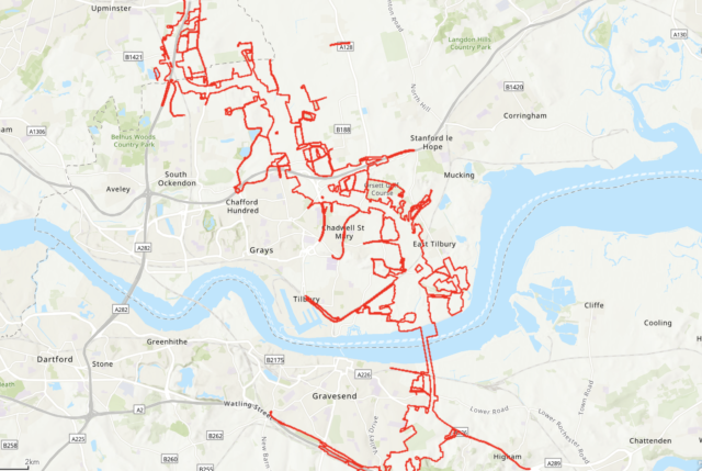
Project-wide impacts
We will explore new ways of building and operating roads in a low carbon future, enhance habitats for wildlife, increase biodiversity and improve air quality to leave the local community and environment better off than when we arrived.
Project-wide impacts, including landscape, climate, geology and soils, archaeology and water management, are covered in the pages on Construction and When the road is open for traffic.